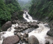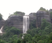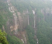






A detailed map of Cherrapunjee’s major waterfalls
Cherrapunjee, officially known as Sohra or Cherrapunji, is surrounded by a remarkable concentration of waterfalls. During the monsoon, streams pour over the Khasi Plateau in broad curtains, narrow ribbons, and powerful cascades. In the dry season, several falls become thinner, yet the cliffs, forests, valleys, and viewpoints remain rewarding.
The waterfalls are spread across different roads rather than arranged along one short walking trail. Nohkalikai lies close to Sohra, Seven Sisters is reached on the route toward Mawsmai and Shella, while Wei Sawdong and Dainthlen require separate drives. A useful waterfall map therefore needs to show both direction and access conditions.
Distances in Meghalaya can be misleading. A road of only a few kilometres may take considerably longer because of bends, rain, village traffic, or steep approaches. The times below are practical estimates from central Sohra and should be treated as flexible rather than fixed schedules.
How the waterfall routes fit together
Central Sohra is the best base for exploring the main falls. Nohkalikai is west of the town, near the edge of the plateau. Dainthlen lies farther along the route toward the Mawsmai and Shella area, while Seven Sisters is generally visited from the same broad side of town. These three can often be combined with careful timing.
Wei Sawdong is reached by taking a road away from the main tourist circuit and then walking down a steep stairway. Kynrem Falls is farther south, near the Thangkharang Park direction, and is usually combined with other southern Sohra viewpoints. Wakaba Falls and the Bishop–Beadon Falls viewpoint also belong to this southern and eastern group.
A simple mental map is useful: west for Nohkalikai, southeast for Seven Sisters and Mawsmai, a separate forested route for Wei Sawdong, and the southern plateau edge for Kynrem, Wakaba, and Bishop–Beadon. Local drivers know these routes well, especially when rain changes road conditions.
Nohkalikai and the western escarpment
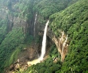
Nohkalikai Falls is the most famous waterfall near Cherrapunjee and one of the easiest major falls to reach. From central Sohra, the drive usually takes about 15 to 25 minutes, depending on the starting point and traffic. A paved approach leads to a designated viewpoint, so visitors do not need to undertake a long forest hike to see the main cascade.
The waterfall drops from a green escarpment into a blue-green pool far below. Its appearance changes dramatically with rainfall: heavy monsoon clouds can turn the cascade into a wide, forceful sheet, while winter often reveals more of the surrounding rock face. The viewing area may become slippery in wet weather, and mist can temporarily obscure the valley.
The viewpoint is suitable for families and travellers with limited walking ability, although there are steps and uneven surfaces in parts of the visitor area. Reaching the pool at the base is not the normal sightseeing experience and should not be attempted casually. The cliffs are steep, and marked viewpoints provide the safest perspective.
Seven Sisters and the Mawsmai side
Seven Sisters Falls, also called Nohsngithiang Falls, is associated with the dramatic limestone landscape southeast of Sohra. The cascade is best viewed from a designated roadside or park viewpoint, usually reached in around 25 to 40 minutes from central Cherrapunjee. The route can be combined with Mawsmai Cave, Arwah Cave, and nearby scenic stops.
The name refers to the multiple streams that descend side by side over the cliff. Their number and strength vary with the season, and during the monsoon they may merge into a broad silver wall. In the drier months, individual channels can become easier to distinguish, while haze may soften the distant valley view.
This is a viewpoint waterfall rather than a destination requiring a descent. Visitors should remain behind railings and avoid walking close to exposed edges for photographs. A morning visit can offer clearer visibility, but changing cloud is part of the landscape and can arrive quickly even after a bright start.
| Waterfall | Approximate direction from Sohra | Typical road time | Access style | Best conditions |
|---|---|---|---|---|
| Nohkalikai | West | 15–25 minutes | Short walk to viewpoint | Monsoon for volume; winter for clearer views |
| Seven Sisters | Southeast | 25–40 minutes | Roadside or park viewpoint | Monsoon and early post-monsoon |
| Wei Sawdong | Forest road away from main circuit | 45–75 minutes | Steep stairway and footpath | Clear weather after rain |
| Dainthlen | Southeast, toward Shella | 30–45 minutes | Short approach to viewpoint | Monsoon for a powerful cascade |
| Kynrem | South near Thangkharang area | 45–70 minutes | Park or viewpoint access | Monsoon and post-monsoon |
| Wakaba | Southern/eastern plateau edge | 30–50 minutes | Viewpoint with uneven ground | Clear days with good visibility |
| Bishop–Beadon | Near the Shillong–Sohra approach | 45–75 minutes | Viewpoint and local access paths | Monsoon for full flow |
Wei Sawdong and the forested descent
Wei Sawdong Falls has become one of the most sought-after waterfall attractions around Sohra because of its tiered shape and striking turquoise pools. It is not as simple to access as Nohkalikai or Seven Sisters. After the vehicle reaches the entrance area, visitors descend a steep series of steps through forest before reaching the viewing points.
The journey from central Sohra can take roughly 45 minutes to an hour and a quarter. The estimate varies significantly with rain and road conditions. The stairway may be wet, muddy, and uneven, so sturdy shoes are more useful than open sandals. The return climb is demanding, particularly after spending time in humid weather.
The falls are most impressive when there has been recent rain, but excessive rainfall can make the descent hazardous and the pools unsuitable for swimming. Even when water looks calm, submerged rocks, strong currents, and sudden changes in flow create risks. Use the established path, follow local instructions, and allow enough time to return before darkness.
Dainthlen, Kynrem, and nearby viewpoints
Dainthlen Falls is reached on the road toward the Shella side of the plateau and generally takes around 30 to 45 minutes from Sohra. Its name is connected with the local legend of Thlen, a giant serpent defeated by a community hero. The surrounding rock formations and broad open landscape add interest beyond the waterfall itself.
The viewpoint usually involves only a short walk, making Dainthlen an efficient stop on a day that also includes Seven Sisters or Mawsmai Cave. During the rains, the water cuts strongly across the rock face. In late winter, the fall may be less dramatic, but the open viewpoint and layered hills remain photogenic.
Kynrem Falls is farther south and is commonly visited with Thangkharang Park. It drops in multiple stages through a forested valley and is particularly attractive during the monsoon. Depending on the exact viewpoint and route used, the drive from Sohra may take 45 minutes to more than an hour. Roads can be narrow, so a local taxi is often more convenient than self-driving.
Wakaba Falls is another scenic stop along the plateau edge. Its appeal comes from the combination of waterfall, cliffs, and sweeping valley views. Bishop and Beadon Falls are associated with the Mawprem area and may be viewed from locations around the Shillong–Sohra route. Their visibility depends heavily on rain, foliage, and cloud cover, so they are best treated as flexible stops rather than fixed highlights.
Building a practical waterfall day
A compact day can begin with Nohkalikai, continue to Dainthlen and Seven Sisters, and finish at Mawsmai Cave or another nearby attraction. This arrangement reduces backtracking and keeps the longest drives manageable. Start early if travelling during the monsoon, since rain can slow traffic and daylight fades quickly behind the cloud-covered hills.
Wei Sawdong deserves a separate time allowance because the stairway descent and climb back up take longer than the distance suggests. Pairing it with too many distant attractions can make the day rushed. Kynrem and Thangkharang Park work well together, while Wakaba or Bishop–Beadon can be added when visibility and road conditions are favourable.
Travellers staying several nights can divide the circuit into two or three outings instead of trying to see every waterfall at once. A six-night Cherrapunjee package can provide enough time for major falls, caves, living root bridges, and nearby Meghalaya destinations without reducing each stop to a quick photograph.
What to carry and when to go
The southwest monsoon, usually from June through September, produces the fullest waterfall flow. July and August can offer spectacular conditions, but heavy rain may bring low visibility, slippery paths, and occasional travel delays. October and November often provide a useful balance of residual water and clearer skies. December through February is more comfortable for walking, although smaller or seasonal falls may be less powerful.
Wear quick-drying clothes and shoes with firm grip. A compact rain jacket is more practical than relying only on an umbrella, especially on exposed viewpoints and forest steps. Carry drinking water, a small snack, personal medication, insect repellent, and a waterproof pouch for phones and documents.
Useful habits for a safer sightseeing day include:
- Check the weather and road conditions before leaving the hotel.
- Use a local driver for unfamiliar rural roads, steep approaches, and rainy-season travel.
- Keep away from cliff edges, unmarked trails, and waterfall pools with strong flow.
- Start the longest walking stop early and return before low light.
- Carry small notes for entry fees, parking, or local guides where required.
Responsible visits around Sohra
Waterfall viewpoints are part of living landscapes, not simply photographic locations. Avoid loud music, littering, and climbing on fragile rock formations. Take reusable bottles where possible, keep food packaging with you, and use marked waste bins or carry rubbish back to the town.
Local communities manage many access points and visitor facilities. Entry arrangements, parking charges, walking routes, and safety restrictions may change with weather or maintenance. Respect temporary closures instead of searching for an unofficial route around them. A local guide can add cultural and ecological context while helping visitors follow the correct path.
Before setting out, confirm the day’s route with accommodation staff or a trusted taxi operator. With sensible timing and proper footwear, Cherrapunjee’s waterfall circuit offers everything from accessible cliff viewpoints to demanding forest descents. Arrange your stay and sightseeing schedule through Cherrapunjee’s travel services so the right routes, distances, and seasonal conditions are built into your Meghalaya holiday.