





Climbing Kyllang Rock: Trails, Views and Travel Tips for Aussie Hikers
Towering roughly a thousand feet above the rolling Khasi Hills, Kyllang Rock is one of Meghalaya's most striking granite monoliths and a magnet for travellers craving a solid day's scramble without committing to a multi-day expedition. Aussies who love a proper bushwalk, the kind that finishes with a cold beer and a sunset, will find the going here both familiar and refreshingly different. The rock sits a short drive from Sohra, the local name for Cherrapunjee, which means travellers can pair the climb with waterfalls, caves and living root bridges in a single itinerary.
The dome is covered in a patchwork of lichens, wildflowers and scattered rhododendron shrubs, with broad slabs and boulder fields giving way to steeper pitches as the track rises. Because the climb is non-technical on most routes, anyone comfortable on a Blue Mountains track back home, or anyone who has scrambled up The Nut in Stanley, can manage the ascent with a bit of common sense and a decent pair of shoes. The reward at the top is a near-360 degree sweep over the Bangladesh borderlands, the Jaintia Hills and the patchwork of valleys that surround one of the wettest places on earth.
The Granite Dome and Its Khasi Legends
Kyllang Rock is a single massive block of granite that rises abruptly from the surrounding plateau, and geologists believe it was exposed by millions of years of erosion that wore away the softer stone around it. The Khasi people have their own explanation, and several oral traditions speak of the rock as a sleeping giant or a petrified spirit that watches over the villages below. Local guides love sharing these stories at the base, especially when a traveller turns up with a packed brekkie and asks for a quick history lesson before heading up.
For Australian hikers, the closest comparison might be a place like Bald Rock in NSW or the granite tors of Girraween on the Queensland border, though Kyllang is on a much grander scale. The flanks are steep but not vertical, which means the climb feels more like an extended scramble than a rock-climbing route. Many visitors find themselves stopping repeatedly to take photos of the boulder gardens, where ferns have colonised the cracks and small orchids cling to the moss. The flora changes noticeably as you gain altitude, and birders can tick off laughingthrushes, barbets and the occasional mountain hawk-eagle circling overhead.
The summit itself is a broad, relatively flat plateau scattered with smaller boulders, which makes it an ideal spot to rest, refuel and simply stare. On a clear arvo, the view stretches for kilometres in every direction, with the distant plains of Sylhet visible as a faint haze to the south. Most organised climbs include a leisurely hour or so up top before the descent, which is exactly what seasoned bushwalkers usually want after a steep pull.
Climbing Routes and How Hard They Really Are
There are essentially three ways up Kyllang Rock, and each one offers a different mix of effort, scenery and bragging rights back at the lodge. The most popular route starts from the village of Mawsmai, where a well-worn footpath leads through farmland before hitting the rock's lower boulders. The first half is gentle walking, the second half gets steeper, and the final push involves a bit of a hands-on scramble over lichen-covered slabs. Travellers who have done the Overland Track in Tasmania or hiked up Bluff Knoll in the Stirling Range will find the grade reasonable, though the humidity makes it feel harder than the numbers suggest.
A second trail approaches from the western flank and is the preferred choice for those who want more solitude. It cuts through cashew and betel nut plantations, crosses a couple of seasonal streams and emerges onto a ridge that runs directly to the summit. The footing is rockier and less maintained, so it pays to take a local guide who knows which boulders shift after heavy rain. Many travellers compare this path to a remote Cape Range gorge walk, with the bonus that you might have the whole rock to yourself if you start early.
The third option is a short, steep access route mainly used by locals heading up to the sacred grove at the top. It is not signposted and respects a few cultural protocols, so going without a guide is considered disrespectful. Anyone keen on this path should arrange it through a local operator who can also explain the customary offerings left near the summit. Whichever trail you choose, the round trip generally takes three to five hours depending on fitness and how often the camera comes out.
Weather Windows and the Best Time to Climb
Cherrapunjee is famous for being one of the wettest places on the planet, and the rainfall shapes everything about climbing Kyllang Rock. The dry window runs loosely from November through March, when the monsoon has retreated and the mornings tend to be clear and crisp. Even then, an afternoon shower is not unheard of, and the rocks can stay slick for hours after rain, so starting at first light is the smart move. Australians used to unpredictable alpine conditions in the Snowies will know the routine: check the sky, layer up, and turn back if the weather closes in.
The monsoon months, June through September, bring torrential rain, leeches and slippery boulders, which is why most operators close the upper trails. Travellers who do venture out in shoulder months should pack a reliable rain shell and accept that the climb may be called off if a squall rolls in. Guides often compare Cherrapunjee's weather to a Darwin wet season, only colder, and they are not far off. Humidity regularly pushes past ninety per cent, so even a short climb can feel like a sauna.
The shoulder months of October and April are a sweet spot for many travellers, balancing decent weather with thinner crowds. Sunrise climbs are particularly magical in this window, with mist pooling in the valleys below and the granite turning a warm pink as the sun clears the ridge. Photographers who chase golden-hour light in places like Uluru or the Bungle Bungles will feel right at home here, and the rock's scale makes even a phone camera look impressive.
What to Pack and Staying Safe on the Slabs
Packing for Kyllang Rock is part travel, part bushcraft, and a little bit of common sense. Sturdy hiking shoes with grippy soles are essential, since much of the upper section is bare rock, and a pair of light trekking poles helps on the descent. Most guides recommend carrying three litres of water per person, a few energy bars, a rain layer, a basic first-aid kit and a head torch in case the climb runs longer than expected. Travellers who book a Cherrapunjee holiday package through established operators like cherrapunjee.net usually have most of this gear supplied or organised in advance.
Leeches are a fact of life in the lower forests during the wet months, so salt, a small pair of tweezers and a willingness to check your socks regularly are useful additions. Salt gives a quick sting to any leeches that hitch a ride, while tucking trousers into socks slows them down. Mobile coverage is patchy on the rock itself, so telling someone your expected return time and sticking with a local guide is non-negotiable. Many Australians are used to relying on personal locator beacons in remote terrain, and the same cautious mindset pays off here.
Cultural respect matters too, since Kyllang Rock sits on community land and the summit grove holds spiritual significance. Guides will explain which paths are open to visitors, where to leave small offerings if you wish, and how to behave near the sacred stones. A friendly "khublei" or thank-you in Khasi goes a long way, and most locals will appreciate the effort. Travellers who treat the climb as a privilege rather than a conquest tend to leave with the best stories and the warmest welcomes.
Pairing Kyllang Rock with the Best of Cherrapunjee
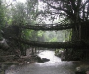
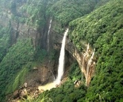
The climb is best treated as one chapter in a longer Meghalaya story rather than a standalone day, and the surrounding region packs in an absurd amount of variety for such a small area. A two-night stay lets you add Nohkalikai Falls, India's tallest plunge waterfall, plus the nearby Seven Sisters viewpoint, both of which sit within an hour's drive. Another popular add-on is the double-decker living root bridge at Nongriat, which involves a steep descent and a fair few hours of stair-counting but rewards visitors with one of the most photographed structures in the country.
Cave lovers can spend a half-day exploring Mawsmai Cave, where limestone formations glow under shafts of natural light, or push deeper into the longer Krem Mawmluh system. For a slower arvo, the village markets around Sohra sell fresh pepper, honey, bay leaves and the local rice wine known as kyat, which is worth sampling in small amounts. Many travellers find that a seven-night itinerary strikes the right balance, mixing adventure days with quieter time at a hilltop resort or homestay.
Getting around is easiest with a driver arranged through your accommodation, as the roads are winding and the locals know exactly where the potholes live. Public transport exists but can be slow for those on a tight schedule. Travellers flying into Guwahati often combine the trip with a stop in Shillong, the state capital, where cafes, bookshops and a certain tea-shop culture feel oddly familiar to anyone who has spent time in Hobart or Fremantle. With the rock as your morning warm-up and the waterfalls as your cool-down, the whole region comes together in a way that feels far bigger than the map suggests.
Ready to lace up the boots and chase that Khasi sunrise? Browse the multi-day tour options and book your spot through cherrapunjee.net, where the team at India Beacons Sojourn can tailor a two-night dash or a full week of monsoon-fed adventure to suit your travel style.