




The strange stone giants of the Sohra region
Far in the north-east of India, where the monsoon clouds spend more days pouring rain than they do anywhere else on the planet, the land around Sohra (the local Khasi name for what maps often call Cherrapunjee) has been slowly sculpted into a landscape that feels almost otherworldly. Whole hillsides have been hollowed out by water, leaving behind yawning limestone mouths, dripping tunnels, and ridges that look as if they were carved by patient giants with sharp chisels. Travellers flying in from Sydney or Melbourne and connecting through Singapore often arrive at Guwahati airport expecting a quiet hill station, and find themselves staring at cliffs and stone arches instead.
The region sits on a thick shelf of limestone and sandstone that the rains have been shaping for millions of years. Because the Khasi Hills catch the full force of the south-west monsoon, every year more than ten metres of water fall on the plateau, and that water has had time to do extraordinary things to the rock. For Australians who grew up bushwalking in places like the Blue Mountains or the Grampians, the scenery will feel familiar in scale but very different in colour, with green moss, slick wet stone, and a permanent mist softening every edge.
What makes the stone here so fascinating is that it comes in many moods. Some formations are delicate, like folded curtains hung across a cave wall. Others are blunt and brutal, like a slab of rock as tall as a Sydney Harbour Bridge pylon, balanced on a thin pedestal. The variety comes from the way the underlying rock was laid down, lifted, fractured, and then attacked by rain from above and rivers from below.
Anyone planning a trip here should understand that the rock formations are not just things to look at from a viewing platform. Many of them are walked through, climbed over, and even tied to, because this is also the home of the famous living root bridges. The entanglement of human craft and natural stone gives the area a layered feel that few other places on Earth can match.
Limestone caves carved by endless rain
The most celebrated stone features around Sohra are its limestone caves, and they are genuinely on a global scale. Krem Mawmluh, Mawsmai, Arwah, and Krem Phyllut together form one of the densest cave networks in the Indian subcontinent, with passages that twist for kilometres beneath the rice terraces. Australians who have explored the limestone caves of Margaret River or the Chillagoe-Mareeba area will recognise the general idea of a karst system, but the Khasi version is wetter, greener, and far more vertical.
Inside Mawsmai, the rock is decorated with stalactites that hang like candle wax and flowstone that looks like frozen rapids. The cave entrance is just a short walk from the main road, so it is popular with day-trippers, but the deeper systems require guides, headlamps, and a steady nerve. Some passages drop into chambers the size of a small concert hall, and the echo of dripping water can sound strangely like distant applause on a still afternoon.
The reason these caves exist at all is the chemistry of water meeting limestone. Slightly acidic rainwater slowly eats away the calcium carbonate, opening cracks into voids, and eventually into the cathedrals you see today. The process is still happening, which means that every visit, and every new monsoon, changes the underground shape a little.
For travellers from Australia, this means good walking shoes with real grip are non-negotiable. The stone is wet almost every day of the year, and polished limestone underfoot behaves much like the rocks around Tasman Sea lookouts after a good southerly blow. Worn soles end the fun very quickly.
The sandstone stage of the plateau
Above the caves, the plateau itself is built from a different stone. Sandstone layers laid down in ancient river deltas have been lifted, tilted, and eroded into a series of dramatic ridges, gullies, and standing pillars. From certain viewpoints near Sohra, you can look out over a sea of green peaks with pale stone walls exposed along their flanks, very much like seeing the Bungle Bungles from a chopper except that the stripes are different and the climate is a thousand times wetter.
One of the easiest ways to appreciate this sandstone architecture is to drive the short stretch of road towards Mawlynnong, voted by several international publications as the cleanest village in Asia. The roadside cuts through the rock and reveals the bedding planes, the colours, and the vertical jointing that controls how the hills break apart. The drivers who run tours in this region usually know which pull-offs give the best angles, so it is worth booking through a local operator rather than racing past in a hire car.
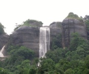
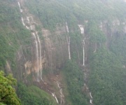
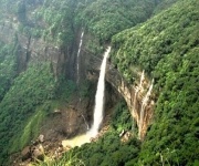
The sandstone also produces the famous waterfalls. Because the rock is relatively soft and well-jointed, water finds easy paths downward and then plunges over the edges of the plateau. Seven Sisters, Nohkalikai, and Dain Thlen falls are all essentially sandstone escarpment falls, and they crash into green pools that are deeper than they look. Standing at the top of Nohkalikai, you can feel the rock vibrating under your boots from the impact of the water hundreds of metres below.
A short kit list for visitors who are not used to heavy monsoon weather:
- Carry a light poncho that can be folded into a jacket pocket, not a flimsy plastic bag.
- Keep phones and cameras in dry bags or zip-lock pouches, because the spray from waterfalls travels surprisingly far.
- Avoid leaning over cliff edges to take selfies; the stone here is often covered in moss that looks solid but is as slippery as wet soap.
- Wear clothing that dries quickly, because going from a humid cave into a wet cliff walk will soak you twice over.
Caves, arches, and the bridges made of roots
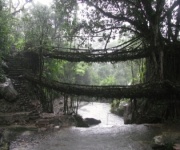
The deep relationship between the people of Sohra and their rock is nowhere more obvious than in the living root bridges. These are not stone arches in the geological sense, but they are organic bridges that have been guided, over generations, to span the same rivers that cut through the limestone and sandstone. The Khasi communities who built them understood the rock and the water before they ever heard the word geology.
A walk down to the double-decker root bridge at Nongriat is one of the great half-day hikes in India. The path itself is a study in stone engineering, with concrete steps laid into the hillside by villagers over many years. You cross rivers on metal walkways, climb through bamboo ladders, and finally arrive at a bridge of living, growing wood that is stronger than the concrete it sits beside.
The ongoing maintenance of these bridges is a story in itself, and one that travellers with an interest in traditional engineering should read about. The piece on the cherrapunjee-s-living-root-bridges-a-maintenance-and-preservation-story page goes into how the local communities keep the root structures healthy and how they balance that work with the steady impact of tourists and changing rainfall patterns.
Around the bridges, the rock is also worth a closer look. Smooth, water-polished sandstone lines the riverbeds, and you can often see potholes drilled into the stone by swirling pebbles, a phenomenon that Australian geology students will know from the granite country around the Harcourt area in Victoria. These are the same potholes, just made by a different river on a different continent.
Monoliths, boulders, and the balancing rocks
A less famous but equally strange feature of the Sohra region is the collection of balancing rocks and standing stones scattered along the plateau edge and inside the forest. Some of these are the size of a ute, perched on contact points so small it seems a strong gust would topple them. Others are house-sized boulders that have been wedged into improbable positions by ancient landslips.
Local guides often point out formations that look like animals, faces, or objects, and the Khasi names for these stones are sometimes more poetic than their English translations. The shapes are not carved by people; they are the result of differential weathering, where harder layers resist the rain and softer ones are eaten away, leaving the rest standing in mid-air like a slow-motion sculpture.
For visitors used to the abrupt silhouettes of Uluru or the dramatic domes of Kata Tjuta, the Khasi balancing rocks will feel like a smaller, greener cousin. They do not dominate the horizon the way the Central Australian monoliths do, but they reward a slower kind of looking, the kind that works best on a quiet morning when the mist is still lifting.
The rivers that shape the stone
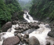
No discussion of the rock formations around Sohra is complete without talking about the water. The Umngot, the Umiam, and a dozen other rivers here are not just scenic; they are the chisels that have made everything else. In the dry months they shrink to clear ribbons over white sand and stone, and in the wet months they swell into brown torrents that move boulders the size of cars.
Boat rides on the Umngot near Dawki are a popular add-on for anyone who has spent a few days walking through caves and down to root bridges. The water is so clear in winter that the boat appears to float in mid-air, a trick that has been photographed by travellers from all over the world, including plenty of Australians who arrive via Delhi or Kolkata and then take the road north.
The rivers also reveal the layering of the rock in cross-section. From a boat you can see stripes of sandstone and shale laid down millions of years apart, each one a chapter in the geological story of the Khasi Hills. It is the kind of slow, layered reading of landscape that Aussies who enjoy the rock art of the Kimberley or the ancient cliffs of the Flinders Ranges will appreciate.
A few simple habits that make a day on the rivers much safer:
- Always check the colour of the water before swimming; clear water usually means safe current, brown water means recent heavy rain upstream.
- Wear old joggers or river shoes rather than thongs, because the submerged rocks are sharp and slimy at the same time.
- Tell your guide or driver exactly when you expect to be back, since mobile signal drops out along many of the gorges.
- Carry a small dry pouch for wallet, passport, and any medicine you might need during the day.
For a traveller thinking about coming to see all of this, the easiest way is to book one of the multi-day packages offered by India Beacons Sojourn, which include transfers from Guwahati, accommodation in well-located resorts, and guides who actually know which stone formation is which. The rock around Sohra has been patient for a very long time, and it is ready whenever you are.