




A Trek to the Mawkdok Dympep Valley Viewpoint
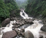
Rain does most of the sculpting in Meghalaya, and the Mawkdok Dympep valley viewpoint in the Sohra hills is where that fact becomes obvious. The viewpoint sits on the rim of a bowl-shaped valley in Mawkdok village, East Khasi Hills, where the Dympep stream drops away below a fringe of bamboo and betel nut. Stand on the timber platform and the floor of the valley opens beneath you: moss-dark cliffs, a ribbon of falling water, and the Kynshi gorge sliding away towards the plains of Bangladesh. Learn more about Akulibur.com.
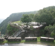
The walk itself is short, which is part of its appeal. From the parking area near the Nohkalikai road, a stone-and-bamboo path of roughly 1.5 kilometres climbs through the village to a flight of steps, and a suspended bamboo bridge carries you over the stream to the viewing platform. Families come for the view and the swings. Walkers come because it is the easiest genuine hillside trek near Cherrapunjee, with enough ascent and enough wet-weather forest to feel like a day's outing rather than a photo stop.
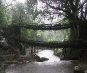
It also fits neatly into the itineraries most visitors book, from two nights for the falls and the caves through to seven nights that reach the living root bridges of Nongriat. What follows covers what the climb involves, when to attempt it, what to carry, how travellers from Australia can reach the trailhead, and where to stay once the fog lifts off the valley.
The valley setting and the climb from Mawkdok village
The Mawkdok Dympep viewpoint belongs to a small village in the East Khasi Hills, a few kilometres along the Sohra road past the turn for Nohkalikai Falls. Khasi speakers read the name Dympep as a word tied to the setting of the sun, and the orientation of the valley supports the idea. Afternoon light slants across the gorge and picks out the wet green of the slopes while the ground below the platform stays in shadow.
The approach begins at the parking area, where a kiosk sells tea, biscuits and raincoats. From there the path runs on stone chips and timber planks laid by the local council, past a row of guesthouses, and then tilts upward through thickets of bamboo. Halfway up, the trail crosses the Dympep stream on a hanging bamboo bridge that sways underfoot, a favourite photo stop in dry weather and a reminder of what the monsoon does to timberwork.
At the top, a small eco-park wraps around the viewing platform. There is a shallow ornamental pond, a rest house with a corrugated roof, and steps dropping towards the water below. The drop into the valley is the reason most people come: a curved amphitheatre of forest with the stream threading its floor. Walk down far enough and the perspective changes completely, from a green bowl to a deep cleft.
The climb takes 30 to 45 minutes at a comfortable pace, and the return is kinder. Total distance runs to around 1.5 kilometres on a circuit path with a modest gain of roughly 100 metres. Good footwear matters more than fitness here, because the steps are uneven, often slick, and loose gravel collects on the bends.
Reaching Sohra from Shillong and the road from Australian cities
Sohra sits about 40 kilometres from Shillong, and the drive takes between 90 minutes and two hours depending on weather and road condition. Most visitors start at Police Bazar in Shillong, where shared jeeps and cars wait for the Sohra run, and where a private car for the day is the sensible option for a group. Shared jeeps leave when they fill, which in the busy months means an early start and a long wait at the far end of the road.
Australians usually arrive through Kolkata, Bengaluru or Delhi, then connect to Shillong's Umroi airport, which has a handful of daily services to Kolkata and connections through to Guwahati. Jet lag and an afternoon connection into Umroi can eat a day out of a holiday, so many travellers build an overnight stay in Shillong before heading up the hill. That night also gives you time to change money, sort permits and pick up local SIMs, which need a passport photocopy and a local mobile number for verification.
Two habits from home need adjusting. Australians drive on the left, and so does India, but Indian hill roads are narrower, busier and shared with livestock, so book a car with a local driver rather than steering the Sohra bends yourself. Second, card and contactless payment habits work in Shillong hotels and larger restaurants but rarely at a roadside tea stall or a market stall at Umsning, where cash in rupees remains the only accepted currency. ATMs around Sohra are few and can be empty, so withdraw in Shillong and carry enough for a couple of days.
Choosing the right month in Meghalaya's monsoon country
Meghalaya records some of the highest rainfall on the planet, with Cherrapunjee and nearby Mawsynram receiving well over 11,000 millimetres a year, and the Mawkdok valley sits squarely inside that belt. The monsoon typically runs from May into early June, dumping rain on the hillsides for weeks and turning the path into a runoff channel.
October to April is the reliable window. The northeast monsoon usually withdraws by late September, leaving clear mornings, deep blue afternoons, and evenings when mist pools in the valleys below the road. February to April is warmer, with heavier thunderstorms in the late afternoon, and the light can be extraordinary right before a squall rolls over the plateau.
Walk in the first hour of daylight if you can. The valley fills with mist that burns off as the sun rises, and the bamboo and the stream catch the early light before the plateau wakes up. Between showers the stone path dries quickly, but the moss never does, and the planks across the stream stay slick long after the ground has dried.
Rain gear is the deciding factor rather than temperature. Daytime temperatures in the cooler months sit in the mid teens, yet wind, damp clothing and the climb make it feel colder, and the famous mossy steps around the region are permanently slippery. Drying out at the end of the day is a genuine concern in air this humid, so a change of dry socks and a warm layer matter as much as the shell jacket.
Falls, bamboo groves and rainforest life along the way
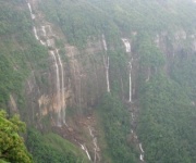
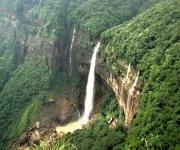
Most trekkers combine the Dympep climb with the neighbouring Nohkalikai viewpoint, a short drive along the same ridge. The Nohkalikai platform looks down on the Kynshi river dropping away in a single 1,475-metre plunge, and from that car park the Mawkdok trail takes about half an hour on foot. The Seven Sisters falls appear in a series of stepped drops further along the road towards Tyrna, while Elephant Falls, named for the shape of the rock, sits closer to town.
The forest is the main event on the trail itself: dense bamboo, betel nut groves grown on family plots, wild cardamom, ferns and orchids in the forks of old trees. You will hear hornbills calling and, more prosaically, the chatter of macaques on the approach to the bridge. Do not feed the monkeys. They take food from hands, learn where visitors pause, and quickly become a nuisance for everyone else using the path.
In the wet months, leeches are a fact of life, and a light pair of gaiters or long socks keeps them out of your boots. If you are walking with children, keep them close on the timber platforms and away from the stream, where the current runs far stronger than it appears from above.
Packing, permits and practical details for the climb
A day pack is enough for the Dympep walk, but a monsoon climate punishes anything cheap. Waterproof trousers, a proper rain shell instead of a poncho that whips away in the wind, and footwear with grip on wet stone make the difference between a pleasant hour and a soaked one. Guides can be hired at the viewpoint for a modest fee, and they know which tracks stay passable after rain and where the quieter photography angles sit.
What to carry for the climb:
- A waterproof jacket and trousers rather than a thin poncho
- Trail shoes or sandals with a secure heel and grippy wet soles
- A small day pack with a waterproof liner for phone, camera and documents
- Gaiters or long socks to keep leeches out of your boots
- A head torch and a power bank for early starts and long drives back
- A refillable bottle, plus a filter if you are cautious about local tap water
What to arrange before you leave Australia:
- A Visitor visa (subclass 600) in the Tourist stream, applied for through ImmiAccount ahead of travel; Australians are not eligible for the eVisitor visa
- An Inner Line Permit for Meghalaya, which foreign visitors currently obtain from the Deputy Commissioner's office in Shillong or the state tourism desk, with the process worth reconfirming
- Travel insurance covering medical treatment and evacuation, since Australia has no reciprocal health agreement with India
- Indian rupees in cash withdrawn in Shillong, with a spare card kept separate from your wallet
- Printed copies of your passport and visa approval, because hotels register foreign guests and roadside checks happen
- Advice from a travel clinic on vaccinations and any prescription medicines carried into the country
If you are still weighing up equipment, independent trekking gear notes and comparisons of rain shells and trail boots are worth a read before you spend money, and some of the reviews cover exactly the Indian monsoon conditions this path throws at you.
Stays around Sohra and how to book the trek
Where you sleep changes the pace of the trek. Sohra has family-run hotels and guesthouses a short walk from the junction, plus larger resorts in Ar wah and Tyrna, where the Seven Sisters and Nohkalikai approaches put you a few minutes from the trailhead in the morning. Staying above the valley also lets you catch the mist burning off before the crowds arrive.
Check-in in India involves paperwork. Hotels register foreign guests with the local authority and will ask for your passport and visa, and the bill carries GST on top of the room rate, at 10% for most hotel and restaurant services and 5% on some tourism services. Australians do not generally reclaim GST on a holiday like this one, so treat the tax as part of the cost rather than something recoverable later.
Package operators sell two-night highlights through to seven nights reaching the living root bridges of Nongriat. Itineraries usually bundle transfers from Shillong, a guide, permits and entry fees, which removes the guesswork from shared-jeep timing. Multi-night package details and resort listings are set out in Cherrapunjee's own travel pages, and it is a sensible place to compare what a self-booked trip costs against a packaged one. Small tipping customs differ too: Australia has a light tipping culture in restaurants, while India runs on service charges and occasional tips for guides and drivers, so a few hundred rupees for a guide who spends half a day with you is appreciated.
The Mawkdok Dympep valley is at its best when the rain has just stopped and the cloud is still lifting out of the gorge, a short climb, a wide view and a cup of tea at the kiosk on the way down. Build it into a longer Sohra stay rather than treating it as a hurried stop, and the trek becomes the memorable part of the trip instead of a photograph squeezed between car rides.
For dates, resort options and current permit requirements, India Beacons Sojourn can shape a two to seven night itinerary around the walk, including transfers from Shillong and a Nongriat root bridge day. Use the booking contacts published on the site, and ask for a plan that places the Mawkdok climb on a clear-weather morning.