





Exploring the Seven Sisters Falls: A Complete Visitor's Guide
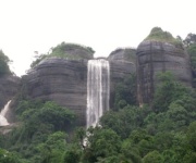
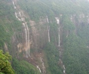
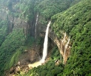
The Seven Sisters Falls tumble in parallel ribbons of white down a forested cliff face near the old, rain-battered hill town of Sohra in Meghalaya, and for most travellers who make it to the far northeastern corner of India they are the first stop on a longer Meghalaya circuit. Locally known as Nohsngithiang Falls or Mawsmai Falls, the cascade is technically a segmented waterfall, where seven distinct streams pour over the limestone edge of the plateau, each fed by a separate spring upstream. The result is a curtain of water that can feel almost cinematic when the southwest monsoon is in full swing.
Cherrapunjee holds the reputation of one of the wettest places on Earth, a fact that tends to draw two kinds of visitors: weather obsessives chasing record rainfall and photographers hunting thundering water in green. For Australians accustomed to long-haul travel and remote landscapes, the falls slot neatly into a broader route through Meghalaya that might include Mawlynnong, Dawki, and the living root bridges of Nongriat.
What follows is a practical, ground-level guide for anyone planning to see the falls, from the approach road and entry gate to viewpoints, season-by-season conditions, and what to pair the visit with once you are already in the area. It is written for travellers flying in from Australia, with notes on flights from Sydney or Melbourne, Indian visa requirements for Australian passport holders, and the kind of gear that handles both tropical rain and cool hill evenings.
How to reach the falls from Cherrapunjee town
The Seven Sisters Falls sit roughly six kilometres south of Cherrapunjee town, just off the Sohra–Shillong road that climbs out of the plateau. From the main Cherrapunjee bazaar, where most resorts and homestays cluster, the drive is about fifteen minutes by car or shared taxi. The road is paved but narrow, with hairpin bends that slow heavy vehicles during the wet months. Visitors who book a multi-day Cherrapunjee itinerary through a local operator usually have the falls slotted in as a half-day morning excursion before the cloud cover thickens over the cliff edge.
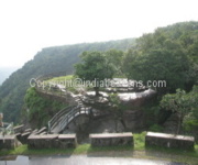
A small viewpoint platform has been constructed at the base of the falls, accessed by a short flight of steps from the parking area. From this lower deck the full width of the seven streams is visible, and a low stone wall keeps visitors safely back from the spray zone. There is also an upper viewing gallery further along the road for those who prefer to look down on the cascade from above, which is often the better angle during the drier months when the lower platform can feel too close to appreciate the scale.
A quick reference for the most-used viewpoints:
| Viewpoint | Best for | Access | Typical visit time |
|---|---|---|---|
| Lower platform | Full frontal view of all seven streams | Short flight of steps from car park | 20–30 minutes |
| Upper viewing gallery | Wide-angle overview, safer during heavy flow | Short walk from upper car park | 15–20 minutes |
| Eastern cliff edge | Quieter spot for landscape photography | Unpaved track, sturdy shoes advised | 30–40 minutes |
| Sohra viewpoint across the valley | Distant landscape and rainbow shots | A few minutes' drive back towards town | 10–15 minutes |
The best season to plan around
Meghalaya's climate is dominated by the southwest monsoon, which runs roughly from June through September and feeds the falls with their most thundering display. This is also when Cherrapunjee earns its reputation: between June and August, monthly rainfall totals regularly exceed 1,500 millimetres, and the falls become a roaring, mist-shrouded wall of water. Travellers who want sheer volume should aim for late June, July, or August, accepting that rain gear, leeches on the lower trail, and occasional road washouts come with the package.
For those who would rather trade water volume for clearer skies, the shoulder months of October and November are widely considered the sweet spot. The rains ease, the air clears enough to see the cliff face properly, and the streams still carry plenty of water from the saturated plateau above. December and January are drier and cooler, and the falls thin to a delicate lacework; this is the time photographers visit for the patterned rock rather than the spectacle. February through May warms again, with the streams shrinking steadily until the next monsoon arrives.
The legend and the landscape behind the seven streams
According to local Khasi folklore, the seven streams represent the seven daughters of a sky spirit, each turned to water so they could pour endlessly from the cliff without ever reaching the valley below. The story is one of several similar legends told across the Khasi Hills, where rivers, falls, and springs are routinely personified as family members. For visitors who arrive with a guide, the tale is usually offered as part of the explanation of the falls' shape and the unusually even spacing of the streams along the cliff face.
Geologically, the falls are the product of a hard limestone cap over softer underlying rock. The plateau is slowly being eroded along its southern edge, and the seven streams have cut their channels into the joint lines of the rock face, which is why the cascade looks unusually regular compared with a single-plunge waterfall. The same process has sculpted the deep gorges and cave systems found across the Cherrapunjee plateau, including Mawsmai and Arwah Caves, both of which sit within a short drive of the falls.
Viewpoints, viewing decks, and photography spots
The lower platform is the easiest place to feel the power of the falls. During peak monsoon, visitors get drenched from a distance of several metres, and waterproof phone covers or rain sleeves are advisable. Most casual visitors spend twenty to thirty minutes here before retreating uphill for a quieter photo stop. The upper viewing gallery, set slightly back along the road, offers a wider lens view that captures all seven streams in a single frame and tends to be calmer in wind.
Photographers chasing more dramatic angles often walk east along the cliff road to a small pull-off where the falls are seen in profile against the valley below. This spot is not officially maintained, so sturdy footwear and a head for heights matter; mist can roll in suddenly and obscure the view within minutes. The eastern pull-off is also a productive spot at first light, when the morning sun catches the spray above the streams and creates the rainbow effects the falls are quietly famous for.
Entry fees, timings, and on-site amenities
The falls are managed as a paid viewpoint, and the entry fee is modest by international standards, currently set at a small per-person charge for Indian visitors and a higher rate for foreign tourists. Tickets are sold at a small kiosk near the parking area, and the same kiosk keeps basic visitor information in English. The site is open from early morning until sunset, with the last ticket typically sold an hour before closing.
Facilities at the falls themselves are limited by design: there are a few benches, a couple of food stalls selling tea, snacks, and local rice dishes, and a small row of souvenir sellers offering honey, spices, and bamboo crafts. Public toilets are basic and can be slick during the rains, so visitors with limited mobility often plan their trip in drier months. Most of the better restaurants and rest stops are back in Cherrapunjee town itself, which is why guided itineraries tend to structure the falls as a morning stop followed by lunch at Sohra market.
Pairing the falls with caves, root bridges, and other Meghalaya highlights
The Seven Sisters Falls sit at the heart of a tightly packed circuit that most visitors cover in two to four days. Within a short drive are the Mawsmai Caves, a lit limestone cave system that takes roughly thirty minutes to walk through and is suitable for almost any fitness level. Further east lies the Arwah Cave, less crowded and richer in fossils embedded in its walls. A typical day might pair the falls with one of these caves and an afternoon stop at the Cherrapunjee viewpoint overlooking the Bangladesh plains.
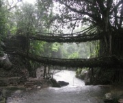
Longer itineraries push further into East Khasi Hills and the neighbouring districts. Mawlynnong, often billed as Asia's cleanest village, is about ninety minutes from Cherrapunjee by road and sits beside the famous single-deck living root bridge. The double-decker root bridge at Nongriat requires a steep 3,500-step return hike and is usually tackled as a separate full day. For travellers with a week to spare, the Dawki river and the crystal-clear waters of Umngot are usually added to round out the picture.
Australian traveller checklist: visas, flights, and what to pack
Australian passport holders need a valid Indian visa before departure, and the standard route for tourists is the e-Visa system applied for online through the official Indian government portal. Visas are typically granted within seventy-two hours, though applying at least a week ahead is the safer practice. Australians should also register their trip with Smartraveller, the Department of Foreign Affairs and Trade travel advisory service, and check the latest advice for Meghalaya and the wider northeast region before flying out from Sydney, Melbourne, or Brisbane.
The most common routing is into Guwahati, the largest city in the northeast and the closest airport with reliable international connections via Delhi or Mumbai. From Guwahati, the drive up to Cherrapunjee takes around four to five hours depending on traffic and weather. Many Australian visitors prefer to overnight in Guwahati on arrival, then continue the next morning. Tour operators familiar with Australian travellers can take care of the Guwahati-to-Sohra transfer, the permits occasionally required for certain border areas, and the local guides who make the falls and their legends come alive.
What to pack for the falls and broader Meghalaya circuit
- A lightweight, fully waterproof jacket rather than an umbrella, which is awkward on the cliff viewpoints
- Sturdy, non-slip walking shoes with good grip for wet limestone steps
- A quick-dry towel and a dry change of clothes for after the spray at the lower platform
- A headlamp or small torch for cave sections such as Mawsmai and Arwah
- A universal power adapter, as Indian sockets follow the Type C and Type D pattern
Nearby spots worth adding to the same itinerary
- Mawsmai Cave for an easy half-hour introduction to Meghalaya's limestone systems
- The Cherrapunjee viewpoint for a wide look at the Bangladesh plains on a clear day
- The living root bridges of Mawlynnong or Nongriat for a longer walking day
- Dawki and the Umngot river for clear-water boating late in the trip
- The town of Shillong, the regional capital, for music cafés, markets, and a slower final night
For travellers weighing up whether to plan the trip independently or with a small local operator, a curated itinerary tends to remove most of the friction: drivers who know which roads close during peak rain, guides who can translate Khasi place names, and accommodation blocks already paid for in advance. Many Australian visitors find it easier to lock in a single multi-day package than to piece the route together on the ground, particularly given the mobile data coverage gaps in the more remote stretches. Independent-minded travellers who prefer to build the route themselves can use a regional search tool to compare Meghalaya and Northeast India options across a range of operators, then layer on the Cherrapunjee stops one by one. If a curated approach appeals, the Cherrapunjee 6N 7D Package offers a tidy way to fold the falls, Mawlynnong, Dawki, and a Shillong night into one trip, with transfers from Guwahati handled end to end.