





How to Use GPS and Offline Maps on Cherrapunjee Trails
Cherrapunjee, also known as Sohra or Cherrapunji, is a rewarding destination for walkers, nature lovers, and photographers. Its routes pass through misty hills, forest paths, waterfalls, limestone caves, streams, villages, and living root bridges. A trail that looks straightforward on a signboard can become confusing when several footpaths divide through dense vegetation.
Mobile navigation makes independent exploration easier, but it works best when prepared before leaving your hotel or resort. Cellular coverage can vary across Meghalaya’s plateau, while rain, cloud cover, steep valleys, and forest can affect both signal and visibility. An offline map gives you a useful position reference even when internet access disappears.
The safest approach is to combine GPS with local directions, daylight planning, weather awareness, and a realistic understanding of the route. Treat the blue location marker as guidance rather than a replacement for trail knowledge. Small errors in a remote area can turn a short walk into a difficult detour.
Why Navigation Matters Around Sohra
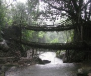
Many Cherrapunjee attractions are reached by a combination of roads, village lanes, steps, and unmarked footpaths. The route to a waterfall may begin beside a main road, then descend through farmland or woodland. A living root bridge trail can involve hundreds of steps and several junctions where the correct direction is not obvious to a first-time visitor.
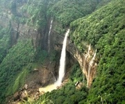
GPS positioning can confirm whether you are moving toward the intended valley, viewpoint, cave, or bridge. It can also help you identify your return route if the landscape appears different in fading light. This is particularly useful after visiting places such as Nohkalikai Falls, Mawsmai Cave, or forested waterfall routes where visual landmarks may be hidden by mist.
Navigation should support local knowledge rather than compete with it. Ask your accommodation, driver, guide, or a nearby resident about the current trail entrance and conditions. A pin saved online may lead to a parking area, an alternative entrance, or an approximate attraction location instead of the actual walking path.
Travelers who want help arranging routes, accommodation, and sightseeing can also review the travel team behind the destination services before planning a longer Meghalaya stay.
Prepare Your Phone Before Leaving
Download the relevant map area while connected to reliable Wi-Fi. In Google Maps, search for the Cherrapunjee and surrounding Sohra region, open the area menu, and save an offline map. Other applications based on OpenStreetMap can provide more detailed footpaths, contours, and points of interest, although coverage differs between apps and trails.
Save every important location separately rather than relying on a single destination pin. Useful markers include your hotel, vehicle parking point, trailhead, bridge entrance, waterfall viewpoint, cave entrance, village, and the place where a driver will collect you. Give each marker a clear name so you can recognize it quickly when several locations appear close together.
Download or screenshot the route description as well. An offline map may show roads but omit stairs, seasonal diversions, private paths, or narrow walking tracks. A screenshot of the planned route, together with a written note of the starting village and return direction, provides a backup if the application closes or the phone battery becomes low.
Before departure, enable location services and test the map in airplane mode. Your phone should still display the downloaded map and locate you through GPS, although the initial position may take longer. Carry a power bank in a waterproof pouch, reduce screen brightness, and avoid streaming music or video throughout the walk.
Read the Landscape Alongside the Map
A GPS map displays position, but it does not always explain what the ground feels like. A line that appears short may descend sharply into a ravine, cross slippery stones, or follow a narrow ledge. Contour lines that are packed closely together indicate steeper terrain, while a winding line through a valley may represent a longer route than the direct distance suggests.
Watch your direction of travel instead of staring at the screen continuously. Check the map at junctions, stream crossings, and major bends, then put the phone away while walking. Compare the digital route with visible features such as ridges, bridges, staircases, streams, exposed rock, and houses. If the landscape does not match the map, stop before continuing.
GPS accuracy can vary under thick forest, beside cliffs, inside caves, or beneath heavy cloud cover. The blue marker may jump several metres or briefly appear on the wrong side of a path. Wait in an open place for the position to settle, then compare the direction of movement with your saved track. A sudden change in the marker is a reason to verify, not to hurry.
| Navigation task | Best practice | Common mistake |
|---|---|---|
| Finding the trailhead | Save the entrance, parking point, and nearby village | Navigating to an attraction name only |
| Walking offline | Download the map and test airplane mode | Assuming mobile data will work everywhere |
| Checking direction | Use a compass view and visible landmarks | Following a blue line without reading terrain |
| Measuring progress | Save a track or note key junctions | Judging distance only by straight-line measurement |
| Returning safely | Set a turnaround time and mark the route back | Continuing after daylight or weather worsens |
| Handling poor accuracy | Stop, wait for GPS, and compare several clues | Taking a wrong turn because the marker jumps |
Choose Map Layers That Match the Trail
A standard road map is valuable for reaching Cherrapunjee from Shillong, Guwahati, or nearby towns, but it may be insufficient for hiking. Look for an app that supports walking paths, satellite imagery, elevation information, and downloadable map tiles. OpenStreetMap-based services can sometimes show footpaths and local landmarks that are absent from mainstream road maps.
Satellite imagery can help identify broad features such as a river, road, open field, or settlement near a trailhead. It is less dependable beneath dense tree cover and cannot confirm whether a narrow path is currently usable. Use it to understand the area rather than treating every visible line as a public route.
A compass app and a simple GPS track recorder are useful additions. A track shows where you have already walked, which is often more practical than trying to remember every turn. If a guide shares a route file, download it before setting out and check that it opens correctly in your chosen navigation application.
Map data can be incomplete or old. Roads may have changed, paths may have been widened, and seasonal water flow can alter crossings. Local guides and residents remain the best source for current information about closures, construction, flooding, or restricted access. Respect signs, gates, cultivated land, and community instructions even if a digital map appears to show a shortcut.
Use Waypoints for Waterfalls, Caves, and Bridges
Break a long outing into recognizable stages. For a waterfall walk, save the road departure point, first descent, stream crossing, viewpoint, and turnaround location. For a root bridge route, mark the village, staircase section, bridge, and return junction. This creates a simple mental map and helps your group communicate if people become separated.
Caves require extra caution because GPS performance may fail underground. Download the surrounding map before entering, remember the cave entrance, and never depend on a phone signal below the surface. Keep your phone protected from moisture and use a small flashlight or headlamp rather than relying on a battery-consuming screen light.
Waterfalls and stream crossings can change rapidly during rain. A route that was passable in the morning may become slippery or unsafe later in the day. If water covers the visible path, do not use GPS to justify crossing. Move to a safe position, ask locally about an alternative, or return while the route remains clear.
For a multi-day visit, organize saved locations by day or attraction. A seven-day itinerary can include many separate pins, so use consistent names such as “Day 3 Trailhead,” “Return Junction,” and “Driver Pickup.” Travelers considering a longer stay can compare the seven-day Cherrapunjee package when coordinating sightseeing with transfers and accommodation.
Plan for Rain, Battery, and Limited Signal
Cherrapunjee is famous for heavy rainfall, and wet weather affects navigation equipment as much as it affects walking conditions. Keep your phone in a waterproof case or sealed pouch that still allows the screen to be used. Pack a dry cloth for the camera and display, and protect printed notes in a resealable bag.
Begin demanding trails early enough to complete the return in daylight. Estimate time for stairs, photography, rest stops, slippery ground, and route-finding rather than relying on the walking time shown by an application. Set a firm turnaround time before starting, especially when visiting a deep valley or a route with many steps.
Share your plan with someone who is not in the walking group. Provide the trail name, starting point, expected return time, accommodation details, and the name of your driver or guide. If you change the route, update that person when you regain connectivity. A charged phone is useful, but a clear itinerary improves safety when technology fails.
Weather can also affect the accuracy of your assumptions. Fog may hide ridgelines and landmarks, while rain can make a familiar route look entirely different. When visibility drops or thunder becomes close, prioritize a safe return over reaching a viewpoint.
Build a Simple Navigation Routine
A repeatable routine reduces mistakes. At the trailhead, confirm the destination pin, identify the direction of the first section, and take a screenshot of the starting area. During the walk, check the map at every major junction and record useful landmarks in a note. When you stop for photographs, make sure the group remains together before moving on.
Use a three-point check whenever you feel uncertain: current GPS position, compass direction, and physical surroundings. All three should broadly agree. If they do not, pause and retrace your last confirmed point instead of exploring an unmarked branch. Walking farther in the wrong direction often makes recovery harder.
Keep essential navigation information available without unlocking the phone repeatedly. A small paper card with the accommodation name, local contact, trailhead, and emergency details can be valuable. Store it separately from your phone, and carry enough cash for local transport or an unexpected change of plan.
Practical Navigation Checklist
- Download offline maps for Sohra, the full route, and the return road before leaving connectivity.
- Save the accommodation, trailhead, parking area, key junctions, and pickup point as individual pins.
- Carry a power bank, waterproof phone protection, a flashlight, and a printed route note.
- Tell a guide, driver, hotel, or trusted contact your walking plan and expected return time.
- Turn around early when rain, darkness, low visibility, or unsafe water crossings alter the route.
GPS and offline maps are most effective when they fit into a broader travel plan. Use them to understand distance and direction, while local advice helps you judge access, weather, and trail conditions. With downloaded information, a charged device, clear waypoints, and sensible limits, you can explore Cherrapunjee’s waterfalls, caves, forests, and living root bridges with greater confidence.
Review suitable Cherrapunjee tours and arrange your preferred dates, accommodation, transport, and guided walks through the available vacation packages. Planning these details before arrival leaves more time to enjoy Sohra’s landscapes without depending on last-minute connectivity.