





Cherrapunjee’s cliffs, caves and the work of rain
Cherrapunjee, also called Sohra, sits on the southern edge of Meghalaya’s Shillong Plateau, roughly 25 kilometres from Shillong. The state’s name means “abode of clouds,” a fitting description when mist crosses the escarpment and thunder builds over the ridges. Travellers come for waterfalls and dramatic rain, but stone, water and time provide the deeper attraction.
The geology of the Cherrapunjee Plateau is clearest along its steep escarpments, where sandstone ends in abrupt walls above forested valleys. Rain enters cracks, roots prise them wider, and streams carry loosened grains away. Across immense spans, this patient removal has cut caves, ravines and high cascades. What appears permanent from a lookout is one stage in a continuing process.
For Australian visitors, the landscape invites comparison with the sandstone escarpments around Katoomba in the Blue Mountains, west of Sydney, and the weathered plateaus of Kakadu in the Northern Territory. Cherrapunjee differs in scale, rainfall and cultural setting, yet differential erosion is visible in both countries. Cliffs remain where resistant beds outlast softer rock beneath them.
The best way to read this landscape is to pause at a waterfall rather than only photograph it. Notice the ledge from which water falls, darker seams guiding the flow and debris collecting below. A multi-day stay reveals more than a hurried stop because clouds, light and access change quickly in the monsoon. Here, geology supplies the drama, while local knowledge explains what you are seeing.
The rock beneath Sohra
Most of the plateau is built from sandstone deposited in ancient river, delta and shallow-sea environments, later raised into a high tableland and exposed to the weather. Variations in grain size and cement strength make the beds erode unevenly. Harder layers form shelves and cliff faces; weaker bands wear into recesses, overhangs and channels. Grey, buff and rusty tones reflect changing minerals and moisture.
Although solid from a distance, the sandstone is crossed by joints and fractures created as the crust moved and the rock was uplifted. Water exploits these weaknesses. A trickle can widen a crack into a ravine, while a larger stream cuts a deeper valley. This structural guidance helps explain why many caves and falls follow distinct breaks in the escarpment.
The upper surface tells a quieter story. Thin soils and dense vegetation mantle gentle slopes above the same ancient rock. Roots stabilise some ground while opening small cracks, linking biological activity to erosion. Farmers on flatter land therefore manage soil depth, drainage and landslide risk as ordinary parts of life.
How the plateau took shape
Meghalaya preserves a vast remnant of an old highland landscape, with deep valleys separating uplifted blocks. The broad Shillong Plateau lies north of the great southward bend of the Brahmaputra, and the southern escarpment drops sharply toward Bangladesh. At Sohra, the tableland ends in a broken rim of cliffs and river gorges. This combination of high surface and abrupt margin concentrates the drops for which the waterfalls are famous.
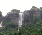
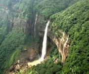
Rivers rising on the plateau use fractures and softer beds to breach the rim. Nohkalikai, among India’s highest waterfalls, plunges from a cliff into a narrow gorge after heavy rain. Its profile shows resistant sandstone, an incised channel and variable water supply working together. In the dry season, the channel may carry only a narrow ribbon through vegetation.
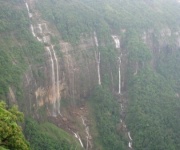
Nohsngithiang, the Seven Sisters cascade, descends across stepped rock shelves and can shift its flow as channels change. Nearby single-drop falls reveal another mechanism: runoff gathers on the plateau, accelerates downhill and falls where the surface breaks. The cascades were not blasted through solid rock at once. Each records water acting on structure over a very long time.
Rain, rivers and relentless retreat
Cherrapunji’s reputation begins with rainfall. The southwest monsoon funnels moist air from the Bay of Bengal into the hills, while uplift helps generate very heavy rain over the plateau. Annual totals vary considerably, and cloudbursts can occur outside the wettest months. The key geological issue is not just the quantity of rain, but how quickly it runs off sandstone and fractured slopes.
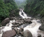
Moving water abrades grains and removes them downstream. During intense storms, even modest streams can undercut ledges, gully slopes and bridge foundations. Fallen blocks break down further, leaving the talus and alluvial deposits that fill valley floors. Water also dissolves and carries some minerals, helping round sharp surfaces and deepen narrow channels.
Erosion also operates through landslides and gravity. Rain saturates weathered material, reduces friction and sends slopes moving in slides. One storm may widen a gully, while another season adds a debris fan below it. Cliffs therefore record slow weathering and sudden collapse together. This shifting balance explains why paths, stream channels and viewing areas can change between visits.
Caves, cliffs and waterfall valleys
Caves develop where groundwater follows joints and bedding planes in sandstone. Erosion enlarges the openings and removes support from the roof. Mawsmai Cave is an accessible example, with passages lit by daylight from hillside openings. Arwah Cave lies in the canyon landscape near Laitlum, reached along a route that follows the valley and stream. Their formation depends on erosion along sandstone weaknesses, rather than limestone dissolution.
Some blue-green pools sit below waterfalls as plunge pools, though depth and safety vary with the season. A look at Cherrapunji’s natural pools guide helps explain what visitors encounter and why swimming choices need care. During monsoon runoff, turbulence and contamination make exposed water unpredictable; at other times, access may depend on local conditions.
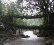
The plateau’s living root bridges belong to the same wet environment, although they are cultural structures rather than geological formations. Their form begins with fig roots guided along rivers and trained by local knowledge. Over decades, the roots interlace and thicken into walkways. The wider destination’s caves, falls and viewpoints allow geology, forest and community heritage to be explored together.
Reading the landscape safely
A cliff can look stable from a viewing platform and still shed loose stone during rain. Stay behind barriers, avoid waterfall bases and do not walk onto wet ledges for a photograph. In Australia, a “lookout” usually means a managed place to stop safely, not an informal roadside pull-off. Local directions may also use “track” for a walking route and “sealed road” for a fully paved road.
Monsoon clouds develop rapidly, so a route clear at breakfast may become slippery by midday. Flash flooding can affect stream crossings even when rain is not falling at the exact location. Allow a turnaround time rather than rushing to the next waterfall. Keep groups together near uneven steps, fog-covered edges and loose slopes.
- Check daily rain and road advisories before leaving Sohra.
- Keep well back from cliff edges, cascades and fast runoff.
- Use shoes with grip and avoid wet rock that cannot be tested safely.
- Follow marked paths and current closures around caves and unstable slopes.
- Carry a charged phone, emergency contact details and a small dry bag.
Some formations may be protected, and access can depend on local permissions or conservation decisions. Confirm current conditions with resort staff, park personnel or your operator before setting out. Viewpoints may close when slopes are unstable. Visitor safety and conservation reinforce each other, while keeping people away from fragile surfaces supports local management.
Planning from Australia
Australian travellers usually reach Meghalaya through Guwahati or Shillong, then continue by road to Sohra. The drive from Shillong takes about an hour in normal conditions, but monsoon traffic and landslides can extend it substantially. The plateau stands near 1,480 metres, so altitude is generally not the main concern; stairs, humidity and wet surfaces demand more attention. October to April is often more comfortable, while monsoon travel offers powerful waterfalls and harder logistics.
Before booking, read current Indian visa guidance and confirm the correct route for your passport and travel purpose. Rules can change, so official procedures should take priority over general advice. A Cherrapunji visit may sit within a larger Meghalaya itinerary. Packages are commonly priced by duration and inclusions, and transport, guide language, meals, entry fees and camera charges can vary between operators.
- Pack a lightweight rain shell, warm mid-layer and spare dry clothing.
- Choose walking shoes with grip for rock, steps and slick paths.
- Carry refillable water, sunscreen, insect repellent and basic medication.
- Keep passport, visa and insurance details accessible offline.
- Confirm transport, guide language, permits and inclusions in writing.
Australia uses kilometres and Celsius, so local signs will feel familiar. Money and connectivity need more attention: carry cash for small services, download maps and translations, and confirm mobile coverage at your resort. An international roaming plan or an Indian SIM supplied by the operator may be more dependable than scattered network coverage. Keep emergency details available even when the landscape limits reception.
Choose your Cherrapunji experience
A two-night stay can cover the main escarpment sights; longer journeys allow time for caves, rain-fed pools and slower forest or village walks. The right base matters. A resort with reliable transport, food and local advice makes a wet-weather itinerary easier to manage. Ask for current waterfall conditions, expected road delays and the actual walking load of each outing rather than relying on a headline distance.
When you are ready, compare the Cherrapunji tours offered by India Beacons Sojourn and select a package that fits your dates, mobility and interest in geology. Whether you choose two nights or seven, request clear inclusions and on-ground support. Pack for clouds, rain and uneven stone, then reserve enough time to watch the plateau reveal its structure one waterfall at a time.