





The most scenic stretches of the Sohra-Shillong highway
The Sohra-Shillong highway compresses an entire Meghalayan journey into roughly 50 kilometres, linking Shillong’s wooded plateau with the wet escarpment around Cherrapunji, also written Cherrapunjee. Sohra has been used for both places over time: it is an old name for Shillong and the present-day name commonly attached to Cherrapunji. That shared label can make navigation confusing, so save the map pins for the right Sohra before setting off. Between the pine-and-eucalyptus slopes, tea country, deep valleys and sudden waterfall views, the route rewards travellers who stop often rather than treating it merely as a transfer between hotels.
The road is most dramatic in the monsoon, when clouds sit against dark rock and water spills from every ridge. Heavy rain can also bring landslides, potholes, poor visibility and slippery surfaces, so a clear view does not automatically mean a safe drive. October to March generally offers easier roads and brighter panoramas, while April and May can balance green scenery with more unsettled weather. Allow at least two hours for the direct drive, then add half a day or a full day for viewpoints, cave entries and short walks. Staying more than one night in the area gives the mountain weather time to reveal its character.
For travellers leaving Sydney, Melbourne or Brisbane, the highway can feel reassuringly familiar in one respect: traffic keeps left in India as it does in Australia. Other details need more attention. Australian cars and phones usually reflect a cashless, contactless payment culture, yet Cherrapunji’s roadside stalls and smaller guides may still need cash in rupees. Urban road habits, overtaking patterns and animal or pedestrian crossings can be unpredictable. A tourist visa, a passport valid for the required period and suitable travel insurance should be arranged before departure, with current requirements checked through official Australian government advice.
Sohra’s forest bends and Shillong’s western edge
The scenic character begins west of central Shillong, where the built-up city gives way to forested shoulders and open patches of roadside settlement. Elephant Falls is the best-known early stop, its broad curtain dropping below a viewing platform in a humid, fern-filled hollow. The walk is short, but the descent can be slippery during rain. Timing matters because cloud often gathers over the upper falls first, then clears as the mist shifts.
Farther along, the police bypass and Orchid Lake area offer a gentler sample of Meghalaya’s highland scenery. Pine, broadleaf trees and tea-coloured slopes frame changing views towards the valley. These are useful places to pause and watch the road traffic settle into its local rhythm. The highway bends can appear moderate on a map, yet heavy commercial vehicles from Shillong need space and visibility, so a local driver’s steady judgment is valuable.
A short detour towards Shillong Peak can extend the day with cloud-filled panoramas over the city and surrounding hills. At more than 2,000 metres, the summit is cool even when Shillong below feels mild. The actual highway segment remains the star, but these western approaches establish the landscape gradually: dense forest, sudden openings, mist, then the broad drop towards the Cherrapunji escarpment.
The Cherrapunji escarpment and Nohkalikai outlook
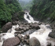
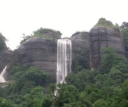
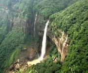
As the road reaches Cherrapunji, the scenery changes from highland woodland to a deeply cut plateau divided by steep, green-sided valleys. Nohkalikai is the signature stop. The waterfall plunges from the escarpment in several stages, and the official viewpoint gives a commanding sense of its height without requiring a technical climb. In wet weather, spray can blur the distant valley and make the drop appear even more immense; in dry weather, the rock face and layered vegetation become easier to read.
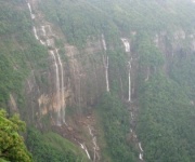
Nearby Nohsngithiang, best known as the Seven Sisters viewpoint, offers a different composition of the same wet-weather landscape. Several separate streams descend across a wide cliff, appearing and disappearing behind mist. The road towards this area also crosses small Khasi villages, gardens and patches of shifting cultivation. Ask before photographing residents, buy from local producers where possible and avoid stopping in a way that blocks a village lane.
These exposed sections make patience essential. Vehicles may queue behind buses on blind bends, and broken shoulders offer little room beyond the tar. Water can cross the road after intense rain, while loose gravel washes onto the carriageway. Stay behind the local traffic, keep headlights on in poor visibility and never walk out onto unmarked cliff edges for a photograph. Developed viewpoints exist to keep visitors away from unstable edges and provide safer places to watch the scenery.
Caves, waterfalls and village roads near Arwah
The Arwah Cave road branches away from the town towards Laitkynsew and climbs through another pocket of the escarpment. Arwah Cave itself is a natural limestone cave reached by a short paved path and steps, with a strong stream running through the chambers. The surrounding forest is dense enough to feel almost subtropical, especially after rain. Guides may point out bats, calcite formations and the cave’s relationship with the streams above.
Further detours towards Bangla and Dympep reveal quieter waterfalls and valleys, but the distinction between highway and village road becomes blurred. A narrow lane might serve as a farm track, school route or all-weather link to a waterfall. The scenery remains rewarding: bamboo groves, orange-brown soil, terraced fields and rock walls stained by runoff. A local driver who knows which roads are passable is more useful here than a detailed list of distances.
Syntung and other outlying valleys can add a full excursion, although they demand more time and careful conditions checking. Some attractions close after heavy rain or landslides, and signage can be minimal. Carry water, a light rain shell and offline map downloads rather than relying entirely on mobile coverage. A pair of sturdy, non-slip shoes handles wet steps better than fashion footwear, and a dry bag protects phones and cameras during sudden showers.
Living root bridges around Tyrna and Riwai
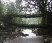
Riwai provides the most accessible introduction to the living root bridges. The single-span bridge crosses a stream in a forested gorge near Tyrna and can be reached by road from Cherrapunji. The journey is scenic before the bridge appears, with the route threading between tea slopes, villages and forest. Visits are best made with a local guide, whose knowledge of the paths and community customs adds context to the impressive engineering.
Nongriat offers the more ambitious version, reached through a longer road corridor followed by a steep walk of a few hours. Its famous double-decker bridge uses trained roots woven across the stream, while another bridge sits higher above it. After the trail, the road continues into quieter countryside. Humidity, rain and slippery footpaths can make the return harder than visitors expect, so the Nongriat trip is better treated as a day with ample daylight than a quick stop appended to a highway transfer.
Respect for the communities is part of the journey. Some bridge routes are private or supported by local conservation groups, and entry arrangements or small contributions may apply. Keep voices down near homes, stay on established paths and ask before using drones. The root structures are living trees maintained by generations of Khasi knowledge; treating them as dramatic scenery alone misses the human story that keeps them standing.
Planning and booking your scenic highway drive
Australians accustomed to long road trips around Melbourne, Sydney or the Great Ocean Road will enjoy the compact scale of this route, but it needs more flexibility. Rural Australian speed limits often sit around 100 kilometres per hour, while limits and enforcement on the Sohra-Shillong highway vary by segment. Seat belts are compulsory, handheld phones are prohibited while driving, and road signs take priority over assumptions imported from Australia. Indian legal requirements also differ: an Australian driving licence should be carried together with an International Driving Permit, and road-hire arrangements need to meet local rules.
Timing the trip around Australian planning habits can save money and stress. Travelling outside school holidays and Melbourne’s major event weekends usually means better hotel availability and less traffic around Shillong. Petrol is readily available in Shillong, but refuelling options become thinner beyond Cherrapunji, so fill the tank before longer detours. Cash remains useful for small tea shops, guides, entry fees and village stalls, while established hotels and tour operators may accept cards. Tipping is optional in Australia, whereas a modest tip for a guide or porter is a welcome acknowledgement of service in India.
These practical choices help visitors experience the highway without stress:
- Choose a multi-night stay: Two nights allow time for the main falls and viewpoints; four to seven nights open up caves, Tyrna, Riwai, Nongriat and slower-paced resort days.
- Travel with a local driver: A Shillong-based driver can judge bends, rain conditions and side roads while the passenger navigates and enjoys the scenery.
- Keep both weather plans: Reserve flexible activity days, carry a rain layer and check attraction or road-closure notices before each excursion.
- Carry rupees and download maps: Bring modest cash for local stalls, keep a payment backup and save offline directions because mobile service can be inconsistent.
- Prepare documents properly: Confirm the e-tourist visa and passport rules, carry the original licence with an International Driving Permit, and note that Cherrapunji does not normally require an Inner Line Permit, though nearby restricted zones can.
Ready to trace the misty bends, waterfall valleys and living root bridges of Meghalaya at your own pace, contact Cherrapunjee for current tour and vacation package options, resort details and booking assistance for journeys from two to seven nights.