





Why Cherrapunjee Is Known as the Wettest Place on Earth
Cherrapunjee, also known as Cherrapunji or Sohra, is famous for receiving extraordinary amounts of rain. Located in Meghalaya in northeast India, the town sits on the southern edge of the Khasi Hills, where moisture-laden monsoon winds meet steep highlands. The resulting downpours have shaped the region’s waterfalls, caves, forests, streams, and living root bridges.
The phrase “wettest place on Earth” is widely associated with Cherrapunjee because of its remarkable rainfall records, particularly during the nineteenth and twentieth centuries. However, the nearby village of Mawsynram generally holds the modern record for the highest average annual rainfall. This distinction does not lessen Cherrapunjee’s reputation: Sohra remains one of the world’s most dramatic examples of extreme monsoon weather and a memorable destination for nature-focused travel.
Understanding the climate requires more than looking at a single rainfall figure. The area’s geography, wind direction, elevation, cloud formation, seasonal rhythm, and long record of weather observations all help explain why so much rain falls in this part of Meghalaya.
Where Cherrapunjee receives its rain
Cherrapunjee lies in the Khasi Hills, a plateau that rises sharply above the plains of Bangladesh to the south. During the summer monsoon, winds from the Bay of Bengal carry large quantities of water vapour northward. When these winds reach the steep southern slopes of Meghalaya, they are forced upward.
As warm, humid air rises, it expands and cools. Cooler air cannot hold as much moisture, so water vapour condenses into dense clouds. These clouds gather along the hills and release prolonged, sometimes torrential rainfall. This process is called orographic rainfall, and it is the central scientific reason for Sohra’s exceptionally wet climate.
The geography is especially effective at concentrating moisture. The southern escarpment faces the incoming monsoon flow, while valleys and ridges help channel air into narrow zones. Instead of passing over a broad, gently sloping landscape, the moist winds encounter a natural wall. The result is intense rainfall over a relatively compact area.
How the monsoon creates extreme rainfall
The southwest monsoon usually dominates Cherrapunjee’s weather from May through September. Rain may arrive as steady showers, heavy cloudbursts, or long periods of continuous precipitation. June and July are often among the wettest months, although conditions vary from year to year.
A single storm can deliver a remarkable volume of water because the clouds repeatedly build over the hills. Moist air continues arriving from the Bay of Bengal, while the terrain keeps lifting it. This combination can produce rainfall measured in hundreds of millimetres within a day, with occasional events becoming even more intense.
Rainfall in Sohra is therefore highly seasonal. The wet months transform the landscape into a network of streams and cascades, while the drier winter period brings clearer skies and easier walking conditions. The annual total is impressive, but the concentration of rain into a few months is just as important. It creates both the region’s lush scenery and its powerful seasonal waterfalls.
The monsoon also affects daily life. Roads may become slippery, visibility can change quickly, and trails around caves or waterfalls may be difficult to navigate. At the same time, rain sustains agriculture, fills streams, supports forests, and contributes to the distinctive ecology that draws visitors from across India and abroad.
Rainfall records and the nearby comparison
Cherrapunjee’s reputation comes from historic weather observations as well as its long-term climate. The town recorded extraordinary annual totals in the past, including a world record for rainfall over a twelve-month period in the nineteenth century. It also recorded an exceptional amount during a single month, demonstrating how concentrated the monsoon can be.
Mawsynram, located roughly a short drive from Sohra, is commonly recognized for the highest average annual rainfall in the world. The two places share the same broad monsoon system and similar hill geography, but local terrain causes rainfall totals to differ from one valley or ridge to another. A small change in elevation, wind exposure, and cloud movement can have a major effect on measured precipitation.
| Location or measure | What it shows | Why it matters |
|---|---|---|
| Cherrapunjee historical records | Exceptional yearly and monthly rainfall totals | Explains Sohra’s enduring global reputation |
| Mawsynram long-term average | Often cited as the world’s highest average annual rainfall | Shows how nearby microclimates can differ |
| Khasi Hills escarpment | Steep terrain facing monsoon winds | Forces moist air upward and triggers condensation |
| June to September season | The main period of intense rain | Concentrates most of the annual precipitation |
| Winter months | Cooler, generally drier and clearer weather | Usually offers easier conditions for sightseeing |
Calling Cherrapunjee the wettest place on Earth is therefore understandable in a historical and popular sense, although the precise scientific title depends on the measurement used. Average annual rainfall, highest monthly total, and highest single-day total are separate categories. Responsible travel information should make that distinction clear rather than treating the phrase as a single permanent statistic.
A landscape shaped by water
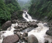
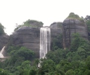
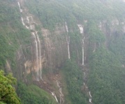
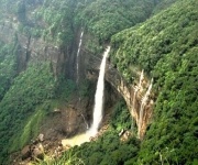
The heavy rainfall is visible throughout the Cherrapunjee region. Waterfalls such as Nohkalikai, Dainthlen, and Wei Sawdong become especially impressive during and after the monsoon. Some flow throughout the year, while others grow dramatically when seasonal rain fills streams and underground channels.
Rain has also helped shape the area’s limestone caves. Over long periods, water containing naturally dissolved carbon dioxide enters cracks in the rock and gradually widens them. This process creates chambers, passages, stalactites, underground streams, and other formations. Several caves near Sohra offer opportunities for exploration, although visitors should use local guidance and suitable equipment.
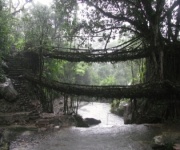
The famous living root bridges reveal another relationship between people, rain, and the natural environment. Khasi communities have trained the aerial roots of rubber fig trees to grow across streams and ravines. Over decades, the roots form strong, living crossings that withstand wet conditions and seasonal water flow. These bridges are cultural achievements as much as natural attractions.
The same rainfall supports thick vegetation and deep green valleys. Ferns, mosses, orchids, and trees thrive in the humid environment, while mist frequently settles over ridges and forest paths. During the rainy season, the landscape can appear almost continuously wet, making waterproof clothing and careful footing essential for visitors.
Why the name still matters to travellers
The older name Cherrapunji remains widely used, while Sohra is the local name and the official spelling often seen in modern references. The town’s association with extreme rain has made it one of Meghalaya’s best-known destinations, but its appeal extends well beyond weather records.
Visitors come for the combination of dramatic scenery and distinctive local culture. Viewpoints look across the Bangladesh plains, waterfalls plunge into forested valleys, and limestone caves offer a different perspective below ground. Villages, sacred groves, hiking routes, and living root bridges add depth to a journey that might otherwise focus only on sightseeing stops.
Rain also changes the character of every attraction. Nohkalikai Falls may appear fuller and more powerful, clouds can wrap around the hills, and short walks may become atmospheric journeys through mist. In the drier season, distant views are often clearer and trails may be more comfortable, although some waterfalls have less water.
Travellers arranging a multi-day stay can use local accommodation and guided routes to balance weather-dependent activities. Practical planning is valuable in a place where conditions can shift rapidly; the Cherrapunjee travel team can provide information about packages, stays, and arrangements for exploring the region.
The best time to experience Sohra
The ideal travel period depends on the kind of Cherrapunjee experience a visitor wants. The monsoon, generally from June to September, is best for dramatic waterfalls, saturated green landscapes, mist, and the full force of the rainy season. It is also the period when heavy rain is most likely to disrupt road travel or outdoor plans.
October and November can offer a useful balance. The landscape remains green after the monsoon, rainfall often becomes less persistent, and many viewpoints and trails are easier to enjoy. December through February is typically cooler and relatively dry, with better visibility for long-distance views and more predictable conditions for walking.
Spring can bring pleasant temperatures and fresh vegetation, although occasional showers are still possible. Weather patterns are not perfectly fixed, so checking a local forecast before travelling remains important. Even during drier months, a waterproof layer is useful in the hills.
A slower itinerary is often more rewarding than trying to visit every attraction in one day. Waterfalls, caves, viewpoints, villages, and root bridges may be separated by winding roads and walking trails. Allowing extra time helps account for rain, traffic, photography stops, and the changing pace of mountain travel.
Practical ways to prepare for the wettest region
Good preparation makes the difference between enjoying Sohra’s climate and struggling with it. Visitors should expect damp surfaces, sudden showers, and cooler conditions when clouds settle over the plateau. Lightweight layers, waterproof footwear, and a reliable rain jacket are more useful than a single heavy coat.
- Carry a waterproof jacket, quick-drying clothes, and spare socks.
- Use shoes with strong grip for muddy paths, rocks, and cave approaches.
- Pack a dry bag or waterproof cover for phones, cameras, documents, and chargers.
- Keep a flexible schedule so heavy rain does not ruin the entire day.
- Follow local guidance near cliffs, rivers, caves, and slippery waterfall trails.
Travel documents, accommodation details, medicines, and electronic devices should be protected from moisture. Visitors travelling from outside India should also check current visa requirements and any relevant permissions before departure. Road conditions and attraction access can change during severe weather, so local operators and accommodation hosts are useful sources of current information.
A respectful approach to the environment is equally important. Carry reusable drinking water, avoid leaving plastic along trails, do not enter restricted cave areas, and treat village customs and sacred landscapes with care. The rainfall that makes Sohra famous also creates fragile habitats and powerful waterways that deserve careful protection.
Plan a Cherrapunjee journey around the season, allow time for the weather to change, and choose experiences that reveal how the monsoon has shaped the hills. With suitable clothing, local knowledge, and a well-paced itinerary, Sohra offers far more than a rainfall statistic: it provides waterfalls, forests, caves, living root bridges, and a vivid encounter with Meghalaya’s mountain landscape.