





A History of the Trade Routes Through the Khasi Hills
Long before motor roads connected Shillong, Sohra and Guwahati, the Khasi Hills were crossed by footpaths linking villages, market centres and the plains of Bengal and Assam. These routes followed ridgelines, valleys and river crossings rather than straight lines, adapting to steep escarpments and the extraordinary rainfall around present-day Cherrapunjee.
Trade was closely tied to geography. The Khasi uplands supplied oranges, honey, turmeric, betel nut, bay leaves, timber and forest produce, while traders carried salt, rice, cloth, metal goods and other essentials uphill from the plains. A journey that looks short on a modern map could take days when it involved slippery stone paths, monsoon-swollen streams and a heavy load.
The old routes were also social corridors. They connected Khasi communities with Jaintia and Garo territories, Sylhet, the Brahmaputra valley and markets farther east. Goods moved through networks of village traders, porters and local authorities rather than through a single central road system.
| Period | Main movement | Historical importance |
|---|---|---|
| Before the 18th century | Forest produce, salt, rice and textiles between hills and plains | Established village-to-market exchange |
| 18th to early 19th century | Oranges, limestone, betel nut and imported goods | Strengthened links with Bengal and Assam |
| British period | Pack routes, cart roads and administrative tracks | Made Sohra a strategic colonial centre |
| Late 19th to 20th century | Road transport replacing head-load carriage | Shifted commerce towards Shillong and Guwahati |
| Today | Tourism, farm products and local handicrafts | Keeps historic corridors economically relevant |
For an Australian visitor, the scale can be surprising. A walking route through the Khasi Hills is not a casual bush track like a short section of the Blue Mountains near Sydney; it is often a working path shaped by centuries of daily use. Weather also changes the experience quickly, much as a clear morning in the Dandenong Ranges can turn into a wet afternoon, though Meghalaya’s monsoon conditions are far more intense.
The Landscape That Shaped Commerce
The Khasi Hills form a high plateau between the plains of Assam to the north and Bangladesh’s lowlands to the south. Cherrapunjee, also known as Sohra or Cherrapunji, sits near the southern edge of this plateau, where dramatic cliffs and deep valleys create natural gateways. The escarpment offered access to markets below, but it also made every uphill journey demanding.
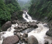
Rainfall dictated the rhythm of trade. During the wet season, streams became torrents and paths turned into mud, yet the same rain nourished orange groves, betel vines, rice fields and forest plants. Traders had to know which crossings were safe, where shelter could be found and which slopes became dangerous after prolonged rain.
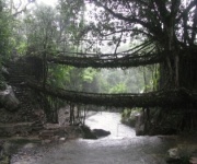
Many paths were built from local stone or compacted earth, with steps cut into steep ground. Living root bridges, created by guiding the roots of rubber fig trees across streams, show how Khasi communities engineered durable crossings from living materials. These structures were practical infrastructure, not simply picturesque attractions for visitors.
Before Colonial Roads Reached Sohra
Trade across the hills existed through customary arrangements between villages and local chiefs. Markets were often held at regular intervals, with people travelling from surrounding settlements to exchange produce and household goods. The exact route taken depended on rainfall, security, seasonal crops and the location of a usable crossing.
Salt was especially valuable in upland areas where it was not produced locally. Rice and dried fish travelled uphill, while forest products and hill crops moved down towards the plains. Betel nut and betel leaf were widely traded, and oranges from the Khasi Hills became particularly sought after in markets connected with Sylhet and Bengal.
These routes should not be understood as isolated Khasi tracks. They formed part of a wider eastern South Asian trading world, with links extending through present-day Meghalaya, Assam, Bangladesh and West Bengal. Bazaars and river ports below the hills helped goods travel onward by boat, while pack carriers handled the steepest sections.
The system depended on knowledge held by local communities. Traders understood seasonal streams, forest conditions and customary rights of passage. This made the routes resilient, but it also meant that outside authorities could not simply take control of them without negotiating with local leaders.
Markets, Chiefs and Borderland Connections
The Khasi political landscape was traditionally organised through many small states and chiefdoms rather than a single kingdom controlling the entire plateau. Local authority mattered at river crossings, market sites and passes. Chiefs and village institutions could influence access, protection and the settlement of disputes between traders.
Sohra became important partly because of its position near the southern escarpment. Its markets connected upland communities with the plains of Sylhet, while paths northwards led towards Shillong and the Brahmaputra valley. Other centres, including Nongstoin, Mawsynram, Jowai and later Shillong, played different roles in regional movement.
The trade was varied in scale. Some exchanges involved households carrying baskets of produce to a weekly market. Others involved organised movement of lime, timber, oranges or bulk agricultural goods. Limestone from the southern hills was used in building and industry, while forest resources entered wider commercial networks.
For Australian travellers, the closest comparison may be the way regional produce once moved between inland towns and coastal ports before sealed highways and refrigerated freight. The difference is that Khasi carriers often worked across steep, wet terrain without pack animals or wheeled transport. Human knowledge and physical endurance were central to the economy.
Colonial Roads And The Rise Of Cherrapunjee
British interest in the Khasi Hills grew during the early nineteenth century, after the East India Company expanded its influence in the region. The colonial administration sought routes between the plains and the plateau for military movement, governance and trade. It also recognised the cooler climate of Sohra, which became an important administrative station for a period.
Existing paths were surveyed, widened and connected to new roads, though development was uneven and frequently contested. Building through Khasi territory involved difficult terrain and negotiations with local authorities. The British also relied on local labour and knowledge, even while imposing new administrative systems and commercial priorities.
The colonial period changed the direction and scale of movement. Roads made it easier to transport supplies, officials and mail, while new institutions encouraged the growth of settlements and markets. Yet foot travel remained essential, especially beyond the main road corridors.
Important goods and travel conditions from this era include:
- Oranges and other fruit carried from upland groves towards markets in the plains
- Limestone moved from quarry areas for construction and industrial use
- Salt, rice, cloth and metal goods brought uphill from lowland trading centres
- Betel nut, honey, turmeric and forest products exchanged through local bazaars
- Letters, administrative supplies and provisions transported along colonial routes
Sohra’s later decline as the principal administrative centre was partly linked to climate and accessibility. Shillong became more prominent as the colonial capital of the Assam province, and transport networks increasingly focused on that city. Even so, routes through Sohra continued to support villages, agriculture and local commerce.
Footpaths, Living Bridges And Historical Memory
Many historic trade routes survive as village paths, although their original commercial function has changed. Some are now used by farmers, schoolchildren and residents travelling between settlements. Others lead to waterfalls, caves, sacred groves and living root bridges that have become important places for visitors.
The Nongriat route is a well-known example of a steep path that brings travellers into a landscape of streams and root bridges. It is best understood as part of a living transport tradition rather than as a route created for tourism. The bridges require years of care, and local communities continue to maintain access through difficult terrain.
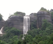
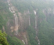
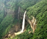
Caves and waterfalls also formed part of the wider geography of movement. Water sources provided rest points, while valleys acted as natural corridors through otherwise challenging ground. Today, a visit to places such as Mawsmai Cave, Nohkalikai Falls or the Seven Sisters Falls can offer clues about how water, rock and elevation shaped older travel patterns.
A historical walk requires practical preparation. Unlike a sealed path in a national park outside Canberra, a Khasi trail may have irregular steps, wet rock and limited signage. Visitors should allow extra time, use sturdy footwear and respect village customs, private land, sacred places and requests from local guides.
Following The Old Routes On A Modern Trip
A history-focused journey through the Khasi Hills works best when it combines viewpoints, markets, villages and walks rather than treating each attraction as a separate photo stop. Start in or around Shillong to understand the later administrative road network, then travel south towards Sohra through landscapes that reveal the transition from plateau to escarpment.
In Sohra, allow time for local interpretation. Waterfalls and caves are spectacular, but the more lasting story lies in how communities adapted to rain, transported goods and built connections across ridges and streams. A local guide can explain names, farming practices and route histories that are rarely visible from a vehicle.
Useful planning priorities include:
- Choose the dry or shoulder season if long walks and village paths are central to the trip
- Carry a light rain jacket, water-resistant footwear and a small daypack
- Keep Indian rupees available for local purchases, guides, entry fees and rural transport
- Check current road and weather conditions before travelling between Shillong, Sohra and nearby villages
- Treat living root bridges and sacred groves as working cultural places, not just attractions
- Build in flexible time, since rain, traffic and mountain roads can alter a daily schedule
Travellers coming from Melbourne or Brisbane may find the humidity familiar, but the combination of tropical rain and highland walking still demands attention. Australians used to tapping a card everywhere should also carry some cash in smaller settlements. If travelling during Queensland or New South Wales school holidays, book accommodation early, since Meghalaya’s popular viewpoints and resorts can become busy at the same time that domestic Indian travel increases.
A short stay can focus on Sohra’s principal sights and one substantial walk. A three-night itinerary gives enough time to see the landscape without turning every day into a long drive. Travellers with more time can use a longer circuit to explore markets, nearby villages and the historical approaches towards Shillong and the plains.
For visitors who prefer a slower pace, a six-night Meghalaya package allows the trade-route story to sit within a broader regional journey. Extra nights make it easier to respond to wet weather, spend time with local guides and visit places where the history is expressed through landscape rather than monuments.
The old paths of the Khasi Hills remain meaningful because they connect past and present. They carried salt and rice, fruit and limestone, news and people. Today, some carry trekkers, farmers and schoolchildren, while roads handle most long-distance freight. Travelling through Sohra with that history in mind makes each bridge, market and mountain pass part of a much larger human map.
Plan your Cherrapunjee journey with India Beacons Sojourn through Cherrapunjee.net, and make room for the routes, communities and landscapes that shaped Meghalaya’s history. Contact the team for current package details, accommodation information and help arranging a trip that follows the Khasi Hills beyond its famous viewpoints.