





Best treks for experienced hikers in Cherrapunjee
Cherrapunjee, also known as Sohra or Cherrapunji, is one of Meghalaya’s most rewarding destinations for strong hikers. Its trails pass through steep hillsides, dense subtropical forest, limestone caves, rushing streams and villages connected by old footpaths. The landscape is beautiful, but the terrain can be demanding even when a route appears short on a map.
Experienced hikers will find the greatest rewards away from roadside viewpoints. The descent to Nongriat, the forest path to Rainbow Falls and longer trails around Sohra require stamina, secure footing and careful timing. During the monsoon, stone steps become slick, streams rise quickly and visibility can change within minutes.
A successful trek here depends on matching the route to the season, starting early and allowing time for the return climb. Local guides add valuable knowledge about weather, river crossings, village customs and less obvious trail junctions. With proper preparation, Cherrapunjee’s demanding walks become memorable journeys rather than rushed sightseeing stops.
How to choose a demanding Sohra trek
The most important factor is elevation change. Several Cherrapunjee trails begin near a road or village and descend sharply into a valley. The return journey can take longer than the descent, especially after rain. A route covering only a few kilometres may still involve thousands of steps, slippery rock and repeated stream crossings.
Fitness level should be judged by more than walking speed. Hikers should be comfortable spending several hours on uneven ground, climbing wet stairs and carrying water, food and rain protection. Trails can include exposed sections, narrow ledges and muddy forest paths, so balance and patience matter as much as endurance.
Season also changes the character of each hike. The monsoon creates spectacular waterfalls and vivid greenery, but it brings the highest risk of landslides, unstable rocks and swollen rivers. October to April generally offers easier walking conditions, although waterfalls may be less powerful and some forest sections can feel warm during the day.
Nongriat and the double-decker bridge
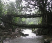
The trek to Nongriat is the essential challenge for visitors who want to combine physical effort with Meghalaya’s living-root-bridge heritage. Most hikers begin at Tyrna, then descend through a long staircase surrounded by thick forest. The route crosses smaller root bridges and streams before reaching the famous Nongriat Double-Decker Living Root Bridge.
The descent is strenuous, but the return climb is the real test. Allow several hours for the complete out-and-back journey and avoid treating it as a quick stop between other attractions. The stone steps can be uneven, and moss makes sections particularly slippery after rainfall. Trekking poles can improve stability, although they should not be used carelessly on narrow bridges.
Starting early helps hikers avoid the strongest midday heat and gives extra time for rest near the village. Carry refillable water bottles, snacks, a compact first-aid kit and a waterproof layer. Visitors should respect the bridge as a living community structure: walk carefully, avoid damaging roots and follow local guidance around homes, farms and bathing areas.
Rainbow Falls from Nongriat
Rainbow Falls is a natural extension of the Nongriat trek and suits hikers who want a longer, more technical day in the valley. From Nongriat, the path follows forested terrain and stream corridors toward the waterfall. The route is quieter than the main bridge area, with denser vegetation and more demanding sections underfoot.
Water levels determine whether the final approach is safe. In wet weather, rocks beside the stream can become extremely slick, and a crossing that appears manageable may be hazardous after overnight rain. A local guide can assess conditions and decide when turning back is the sensible choice. Swimming should be avoided when currents are strong or the pool is difficult to exit.
The return to Tyrna combines the Rainbow Falls route with the full climb from Nongriat. Hikers should carry enough food and water for the extended day rather than relying on shops along the trail. Once back at the upper village, a viewpoint stop can provide a gentler way to end the outing; the area’s sunrise and sunset viewpoints are especially appealing after a demanding valley trek.
Comparing routes by effort and terrain
No two Cherrapunjee hikes feel identical. Nongriat is staircase-heavy, while cave routes require careful movement through darkness and confined spaces. Longer regional trails can be less crowded but may have less obvious signage, making navigation and local support more important.
The estimates below are broad planning ranges rather than fixed itineraries. Rain, trail repairs, photography stops, stream conditions and the fitness of the group can change both distance and duration. Confirm current access with a local operator or guide before setting out.
| Route or trek | Typical effort | Main terrain | Best suited to |
|---|---|---|---|
| Tyrna to Nongriat and return | Very strenuous | Long stone staircase, forest paths, bridges | Strong hikers seeking a full-day challenge |
| Nongriat to Rainbow Falls and return | Very strenuous | Streamside trail, wet rocks, forest | Experienced hikers with good footing |
| Mawsmai and nearby cave walks | Moderate to strenuous | Limestone passages, uneven rock, narrow sections | Hikers comfortable in confined spaces |
| Arwah Cave approach | Moderate to strenuous | Forest trail, muddy ground, cave entrance terrain | Trekkers wanting a quieter cave experience |
| Sohra waterfall and valley trails | Moderate to strenuous | Slopes, village paths, wet stone, viewpoints | Flexible hikers combining several short routes |
| Regional long-distance village trails | Strenuous to very strenuous | Forest, farmland, ridges and changing surfaces | Guided groups with strong endurance |
Cave trails and limestone terrain
Mawsmai Cave is one of the most accessible cave experiences near Cherrapunjee, but its popularity should not disguise the physical demands inside. The limestone passage includes low ceilings, uneven floors and sections where hikers must bend, step carefully or use their hands for balance. Water can collect on the floor, especially during the rainy season.
Arwah Cave offers a more atmospheric alternative, with a forest approach and fossil-bearing limestone formations. The entrance trail can be muddy and less straightforward than a standard attraction pathway. Inside, darkness, humidity and irregular rock surfaces require slow movement. A headlamp is more useful than a phone torch because it leaves both hands free.
Caving should be treated as a separate skill from hill walking. Avoid entering during severe rain, as water flow can increase quickly in underground channels. Wear footwear with reliable grip, leave loose jewellery and bags behind where possible, and never touch fragile formations. A guide familiar with the cave system can identify safer routes and explain which areas should remain undisturbed.
Longer walks beyond the main attractions
Hikers seeking a less predictable day can explore village-to-village paths around the Sohra plateau and nearby valleys. These routes may connect farmland, forest patches, streams and ridge viewpoints rather than leading to one famous landmark. They offer a closer look at local landscapes and daily life, but navigation is more complex than on the established Nongriat route.
The David Scott Trail, reached outside central Cherrapunjee, is another option for experienced walkers interested in Meghalaya’s historic paths. Its character varies along the route, with forest, open hills, river scenery and village sections. Because access points, route conditions and transport arrangements can change, it is best planned as a guided excursion rather than improvised from a general map.
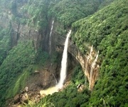
Some waterfalls and viewpoints around Sohra also involve steep approaches that are easy to underestimate. Wei Sawdong, Kynrem and other scenic locations may include stairs, muddy tracks or short scrambles. They can be combined into a broader day, but a packed itinerary leaves little margin for weather delays. Prioritise one major trek and treat additional stops as optional.
Planning around weather and local guidance
Begin demanding walks early, particularly during the warmer months. Morning departures provide more daylight for the return journey and reduce the chance of being caught on unfamiliar ground after heavy afternoon rain. Check the forecast locally rather than relying only on a broad regional prediction, since showers can vary significantly between the plateau and the valleys below.
A guide is strongly recommended for Rainbow Falls, longer village trails, cave approaches and routes affected by recent rain. Guides can help with directions, stream crossings and communication in rural areas. They also support local communities and make it easier for visitors to follow expectations about photography, private land and village etiquette.
Build transport time into the schedule. Trailheads such as Tyrna are reached by road from the main Cherrapunjee area, and returning hikers may need a pre-arranged vehicle. Mobile coverage can be unreliable in valleys, so share the day’s plan with accommodation staff or a tour coordinator before leaving.
Essential preparation for the trail
Packing for experienced-level hikes in Cherrapunjee should focus on weather protection, grip and self-sufficiency. Keep electronics and spare clothing in dry bags, and use a small backpack that leaves both hands available on steep steps or rocky ground.
Recommended essentials include:
- Waterproof hiking shoes with firm soles and a second pair of dry socks
- Lightweight rainwear, a pack cover and sealed bags for valuables
- Two or more litres of water, plus energy-rich snacks for the return climb
- Headlamp, basic first-aid supplies, personal medication and insect repellent
- Offline maps, emergency contacts and enough cash for local services
Avoid relying on umbrellas for forest or cave routes, where they restrict movement and offer little protection from wind-driven rain. Trekking poles are useful on long stairways, but hikers should still keep one hand free for balance. A small towel, quick-drying clothing and a whistle can also be practical additions.
Respect for the environment is part of good trekking practice. Carry every wrapper back, avoid loud music near villages and waterfalls, and do not enter restricted areas. Leave plants, fossils, cave formations and living root bridges untouched so that these places remain safe for residents and future walkers.
A Cherrapunjee holiday can be arranged around a single demanding trek or a multi-day programme that includes caves, waterfalls, viewpoints and local villages. India Beacons Sojourn, the operator behind Cherrapunjee.net, can help coordinate accommodation, transport and guided excursions suited to the season and the group’s ability. Review the available travel packages and contact the team before arrival to plan a route with realistic walking times, local support and room for the weather to change.