



Scenic border roads from Cherrapunjee through Meghalaya
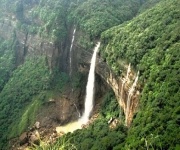
Cherrapunjee, also known as Sohra or Cherrapunji, is famous for waterfalls, mist-covered cliffs and living root bridges. Yet some of the region’s most memorable views appear between the main attractions, when the road leaves the busy tourist circuit and follows ridgelines, forest edges and valleys facing Bangladesh.
These journeys are less about reaching a destination quickly and more about watching Meghalaya change outside the window. A bend may reveal a green plateau, a distant escarpment or a strip of lowland stretching toward the international boundary. Small markets, village paths and roadside viewpoints add a human scale to the landscape.
The best border-road outings from Sohra can be arranged as day trips or included in a longer Meghalaya holiday. Distances are manageable on a map, but winding roads, monsoon showers and frequent photo stops make travel times longer than expected. A flexible schedule will let the scenery set the pace.
Why these roads feel different
The roads south and east of Cherrapunjee pass through one of the most dramatic transitions in northeast India. Sohra sits on a high, wet plateau, while the plains of Bangladesh lie far below the escarpment. On clear days, the contrast between cloud-covered hills and the flat lowlands is striking; in mist, the same route becomes quiet, atmospheric and almost otherworldly.
Many stretches are narrow and uneven, with exposed bends and sections under repair. That slower pace is part of the experience. Drivers familiar with Meghalaya are better prepared for sudden fog, grazing animals, pedestrians and rainwater crossing the carriageway. A private vehicle with an experienced local driver is generally more comfortable than trying to fit every stop into a rigid timetable.
The long view toward Dawki
The journey from Sohra toward Dawki is one of the most rewarding ways to connect the plateau with the Bangladesh border. Depending on the chosen route and road conditions, the drive may pass through Shillong-side roads, Pynursla or smaller settlements in the East Khasi Hills. The changing scenery is the main attraction: pine and broadleaf forest give way to open hills, cultivated slopes and deep river valleys.
Dawki is best known for the Umngot River, whose clear water can appear glass-like during the drier months. Boat rides and riverside views are popular, but the approach to town is equally scenic. As the road descends and the air becomes warmer, the terrain opens toward the border crossing at Tamabil. Visitors should remember that the crossing is an official international checkpoint, not a casual sightseeing area; entry into Bangladesh requires the correct passport, visa and border procedures.
A full day allows time for riverside stops, lunch and photographs without turning the drive into a race. In the wet season, river colour and visibility can change quickly, so the most attractive view in the morning may look completely different by afternoon. That variation is part of Dawki’s appeal.
The Pynursla and Mawlynnong route
The road through Pynursla and onward toward Mawlynnong offers a gentler borderland experience. Rather than focusing on one dramatic viewpoint, it reveals a sequence of forested slopes, village gardens, betel-nut groves and distant plains. Pynursla is a useful place to pause for refreshments and observe everyday life away from the larger tourist centres.
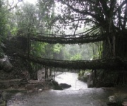
Mawlynnong is often paired with the journey because of its tidy village lanes, gardens and nearby viewpoints. Riwai’s living root bridge can also be included, although reaching it involves a walk down steps and along a forest trail. Visitors travelling with young children may find practical guidance in this resource on travelling with children, especially when planning walks, weather breaks and safe roadside stops.
From Mawlynnong, the road toward the Bangladesh-facing viewpoints can be narrow and pleasantly unhurried. The famous Sky View Point near Nohwet provides a high perspective toward the plains, but the exact visibility depends heavily on cloud and haze. Even when the distant country is hidden, the layered hills and village landscape make the drive worthwhile.
Borderland detours worth slowing for
Bholaganj, also called the Jaflong area in some travel references, lies near the southern edge of the Khasi Hills and is known for river scenery, stone collections and views toward Bangladesh. Access conditions and the suitability of particular roads can vary, so this area is best visited with current local advice. It may be more practical as part of a route from Sohra or Shillong than as a rushed side trip from Dawki.
The Shella region offers another appealing direction for travellers who enjoy quiet roads and river valleys. It is associated with old trade routes, limestone landscapes and access toward the plains. The road may feel more rural than the better-known tourist routes, with fewer facilities and limited mobile connectivity. Carrying drinking water and allowing extra daylight hours is sensible.
Near the border, viewpoints should be treated with respect. Some stretches may be monitored by security personnel, and photography can be restricted around official installations, bridges or checkpoints. Stay on public roads, follow instructions and avoid wandering across marked boundaries. Scenic travel is most enjoyable when it remains considerate of residents and local regulations.
| Route or drive | Main scenery | Suitable time | Important planning note |
|---|---|---|---|
| Sohra to Dawki | Escarpments, forests, Umngot River and border plains | Full day | Allow extra time for rain, traffic and boat activities |
| Pynursla to Mawlynnong | Village roads, forest, gardens and distant lowlands | Full day or overnight | Combine with Riwai and a village stay |
| Mawlynnong to Nohwet | Hillside views toward Bangladesh and rural lanes | Half to full day | Cloud can obscure the panorama |
| Sohra toward Shella | River valleys, limestone country and quieter settlements | Full day | Confirm road conditions and available facilities |
| Bholaganj area | Stone beds, lowland views and border landscapes | Full day | Use local guidance for access and photography rules |
When to drive for the clearest scenery
October to April is generally the most comfortable period for long scenic drives. The post-monsoon landscape remains green, roads are often easier to manage and visibility can improve after the rains. Winter mornings may bring haze, but sunlight later in the day often opens the views across the plains.
The monsoon from June to September creates spectacular waterfalls and intensely green hills, but it also brings landslides, slippery roads and sudden visibility changes. A route that was open earlier in the day may require a detour after heavy rain. Travellers visiting during this season should keep plans adaptable and rely on current advice from their accommodation or tour operator.
Early starts are useful for both scenery and safety. Morning light can sharpen the outlines of distant hills, while leaving before peak activity gives the driver more time to handle slow sections. Avoid planning a remote border-road return after dark, particularly when weather is unsettled.
Travel choices that improve the day
A good vehicle and a realistic itinerary matter more than squeezing in every named attraction. Sedan cars are comfortable on major roads, while a higher-clearance vehicle may be preferable for rougher village approaches. Travellers prone to motion sickness should sit near the front, eat lightly before departure and carry medication.
Build the day around a few meaningful stops rather than a checklist. A viewpoint, village meal, short forest walk and riverside pause will usually create a better memory than six rushed photographs. Keep small cash denominations available because card payments and ATMs may be unreliable outside larger towns.
- Begin with the longest road section while daylight and energy are at their best.
- Carry water, snacks, rain protection, sun protection and a small first-aid kit.
- Wear shoes with firm grip for root bridges, viewpoints and wet steps.
- Confirm road conditions, local access rules and weather before leaving.
- Keep passports and travel documents secure, but do not carry them casually into restricted areas.
Accommodation in Sohra, Mawlynnong, Shillong and around Dawki makes it possible to divide the journey over several days. A two-night stay can cover the main Sohra attractions and one border-facing drive, while a longer Meghalaya package allows Dawki, Mawlynnong, caves, waterfalls and village roads to be enjoyed without excessive driving.
Make the road part of the holiday
A border-road excursion from Cherrapunjee works best when it is treated as a landscape journey rather than simple transport between attractions. The destination may be Dawki’s river, Mawlynnong’s village paths or a viewpoint above the Bangladesh plains, but the forest bends, roadside conversations and shifting weather often become the highlights.
Plan your route with a local Meghalaya travel specialist, reserve suitable accommodation and leave room for changing conditions. Cherrapunjee.net offers multi-day holiday packages and local travel support for arranging scenic drives around Sohra, Dawki, Mawlynnong and nearby attractions. Contact the team to shape a comfortable itinerary that brings Meghalaya’s border landscapes into the centre of your trip.