





The Complete History of Cherrapunjee as a British Hill Station
Cherrapunjee, traditionally known as Sohra and officially called Cherrapunji in many records, occupies a distinctive place in the history of British India. Perched on the southern edge of Meghalaya’s Khasi Hills, it was shaped by geography, monsoon weather, indigenous Khasi society, Christian missions, and the strategic ambitions of a growing colonial administration.
The British did not develop Sohra in quite the same way they developed Shimla, Darjeeling, or Ooty. It became an administrative and missionary station before it became a destination for recreation. Its importance came from its position near the Bengal plains, its access to Khasi territories, and its remarkable climate. Colonial officials soon discovered that the same rain that made the plateau agriculturally difficult also made it an unrivalled centre for meteorological observation.
Understanding the town’s past requires looking beyond old bungalows and rainfall records. The story includes Khasi political independence, military resistance, road building, education, religious change, mining, and the eventual transfer of administrative power to Shillong. These layers remain visible in Sohra’s churches, cemeteries, pathways, bridges, and surrounding villages.
Khasi Country Before British Rule
Long before the arrival of British officials, the plateau around Sohra was home to Khasi communities with their own political institutions, customary laws, markets, agricultural practices, and sacred landscapes. Khasi territories were governed through a network of traditional chiefs, often referred to as syiems, whose authority extended over defined areas and villages. Sohra was among the most influential settlements in the region.
The Khasi Hills were connected to the plains through a series of steep routes and trade paths. Limestone, oranges, honey, betel nut, forest products, and other goods moved between the uplands and markets in what is now Bangladesh. These routes gave Sohra commercial value, while the escarpment provided a natural boundary between the humid plains and the highland communities.
British interest increased after the East India Company gained control over Bengal in the eighteenth century. The colonial government wanted dependable communication between the plains and Assam, where British influence was expanding. It also sought safer routes for trade and military movement. The Khasi Hills were not an empty frontier waiting to be developed; they were an organised region whose leaders had to negotiate, resist, or cooperate with a new outside power.
The British Advance Into The Khasi Hills
During the early nineteenth century, British officials began negotiating with Khasi chiefs for permission to construct a road through the hills. The proposed route would connect the Bengal plains with the Brahmaputra Valley and assist the movement of troops, officials, and commercial goods. David Scott, an important colonial administrator on the northeastern frontier, played a leading role in these negotiations.
Initial agreements did not remove Khasi concerns. Road construction brought labour demands, survey teams, military escorts, and increasing interference in local affairs. In 1829, resistance intensified when several Khasi chiefs attacked a British party at Nongkhlaw. This event led to the Anglo-Khasi War, which continued for several years as British forces attempted to establish control over the plateau.
British troops eventually gained the advantage through superior resources and a combination of military pressure and political negotiation. Yet the campaign was costly and difficult. Dense forests, steep terrain, heavy rain, and the decentralized nature of Khasi authority made the region challenging to occupy. The conflict also left a lasting memory of resistance, especially in connection with U Tirot Sing, the chief of Nongkhlaw who became a prominent figure in Khasi history.
By the 1830s, the British had established firmer control over Sohra and neighbouring areas. The settlement’s strategic value grew because it could serve as a highland headquarters close to the plains. Administrative buildings, roads, military facilities, postal arrangements, and European residences gradually altered the town’s appearance.
A Hill Station Built For Administration
Sohra’s colonial development differed from the image of a classic British summer retreat. The town was used primarily as an administrative centre, a base for political officers, and a gateway into the Khasi and Jaintia Hills. Officials valued its elevation and relative distance from the heat of the plains, but the settlement’s relentless rain made daily life very different from the dry, mild seasons preferred in many other hill stations.
Government offices and residential compounds appeared alongside Khasi villages and traditional land-use areas. Colonial roads were cut across difficult terrain, and bridges helped connect isolated communities. The route from the plains was especially important, although landslides, swollen streams, and damaged surfaces regularly disrupted travel. For British officers, the journey itself demonstrated both the strategic importance and the physical isolation of the station.
Sohra also developed a European social and institutional presence. Churches, cemeteries, schools, dispensaries, and government facilities became part of the colonial landscape. Some structures were modest compared with the grand architecture of Shimla, but they reveal how the British administration functioned in a remote frontier environment.
The town’s official importance declined after the government shifted the capital of the Assam province to Shillong in 1864. Shillong offered a more manageable climate, broader space for expansion, and better administrative conditions. Sohra remained significant as a district centre and communications point, but it no longer held the same regional prominence. This change explains why the town contains traces of colonial authority without displaying the extensive government architecture associated with India’s major imperial capitals.
Missionaries, Schools, And Cultural Change
Christian missionaries arrived during the early colonial period and made Sohra one of the most important centres of Protestant activity in the Khasi Hills. Welsh missionaries, including Thomas Jones, are closely associated with the development of education and written Khasi. Jones arrived in the region in 1841 and worked to create a system for recording the Khasi language using the Roman alphabet.
The mission effort extended well beyond church services. Schools introduced literacy, biblical education, and new forms of instruction, while printing and translation helped establish written Khasi as a medium of communication. Missionaries also documented local vocabulary, customs, oral traditions, and social practices. Their work created educational opportunities, yet it also formed part of a wider colonial-era process that challenged existing beliefs and institutions.
Sohra’s churches and mission schools therefore represent a complex legacy. They are connected with literacy, publishing, and the growth of modern education, while also reflecting the pressure placed on indigenous religious traditions. Many Khasi families adopted Christianity, particularly in areas where mission schools became influential, but local language, kinship systems, music, and community identity continued to shape daily life.
The mission period also helped connect Sohra with wider networks. Printed material travelled between the Khasi Hills, Bengal, Assam, and Wales. Teachers, clergy, administrators, and students contributed to an expanding intellectual life. For visitors today, historic churches and cemeteries can offer a more complete picture of the town than colonial government buildings alone.
Rainfall, Science, And The Colonial Imagination
Sohra became internationally famous because of its extraordinary monsoon. The southern escarpment faces moisture-laden winds from the Bay of Bengal, and the rising terrain forces humid air upward. As the air cools, intense rainfall develops over the plateau. This geographic process shaped every part of settlement history, from architecture and transport to agriculture and public health.
British surveyors and meteorologists measured the rain with increasing regularity. Cherrapunjee became associated with some of the highest annual rainfall totals ever recorded, including more than 26,000 millimetres during the exceptionally wet year of 1861. The records attracted scientific interest and helped place this remote hill station on maps, in newspapers, and in geographical writing throughout the British Empire.
| Period | Historical development | Importance for Sohra |
|---|---|---|
| Before the 1820s | Khasi chiefs governed local territories and trade routes | Established the region’s political and cultural foundations |
| 1820s | British road-building negotiations began | Increased colonial interest in the plateau |
| 1829–1833 | Anglo-Khasi War | Brought stronger British control over the Khasi Hills |
| 1830s–1850s | Administrative offices, roads, and mission institutions expanded | Turned Sohra into a colonial hill station |
| 1841 onward | Welsh missionary education and written Khasi developed | Encouraged literacy, printing, and cultural change |
| 1861 | Exceptional rainfall was recorded | Made Cherrapunjee famous in global meteorological history |
| 1864 | Assam’s capital moved to Shillong | Reduced Sohra’s regional administrative importance |
| After 1947 | The area became part of independent India | Began a new phase of regional and tourism development |
Rainfall influenced colonial construction in practical ways. Roofs needed steep pitches, walls required protection from persistent dampness, and roads demanded constant repair. During the wettest months, movement between settlements could become slow or impossible. Supplies, mail, and official communications were vulnerable to washed-out roads and swollen rivers.
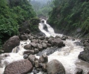
The weather also shaped the British image of Cherrapunjee. Travel accounts often described it as spectacular, gloomy, remote, or unhealthy, depending on the writer’s expectations. Yet the rain supported forests, streams, waterfalls, and living root bridge traditions that now form part of the area’s strongest appeal. The colonial fascination with weather helped create the town’s global reputation, but local communities had long understood the landscape through seasonal knowledge and practical adaptation.
From Colonial Outpost To Modern Sohra
After Indian independence in 1947, the structures of British administration gradually gave way to institutions of the Indian Union and later to the government of Meghalaya. The old colonial hierarchy disappeared, but roads, schools, churches, district facilities, and settlement patterns continued to influence the region. The official use of Sohra alongside Cherrapunji reflects the continued importance of Khasi identity and local naming traditions.
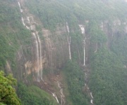
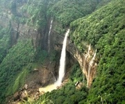
For much of the twentieth century, the area remained associated with agriculture, forestry, education, government work, and limited commerce. Travel was often difficult, and many natural sites were known mainly to nearby communities. Waterfalls such as Nohkalikai, caves including Mawsmai, and the forest paths leading to living root bridges gradually became better known outside the region.
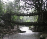
Tourism now connects historical interest with the natural environment. Visitors can explore sites linked to colonial-era travel while also learning about Khasi ecological knowledge. Living root bridges, for example, are not British monuments, but they reveal an indigenous engineering tradition that developed through long familiarity with monsoon rivers and forest growth. Their presence helps place colonial history within a much older cultural landscape.
A well-planned visit can also support local businesses and provide a more balanced view of the destination. Cherrapunjee.net’s family travel guide is useful for travellers organising a trip across different age groups, especially when combining heritage sites, waterfalls, caves, and walks.
Historic Places And What They Reveal
The surviving landmarks around Sohra rarely tell a single story. A church may reflect missionary education, colonial connections, Khasi adaptation, and the growth of a modern community at the same time. A cemetery may record the presence of officials and families who died far from Britain, while also showing how difficult life could be in a remote, rain-soaked station.
The old routes are equally meaningful. Roads and footpaths built or improved during British rule followed older indigenous movement corridors in many places. They connected administrative centres with markets and villages, but they also altered patterns of trade and mobility. Today, travelling across the plateau makes it possible to see how engineering, terrain, and local knowledge interacted.
Visitors interested in the history of Cherrapunjee should allow time for both formal attractions and less obvious details. Look at building materials, roof forms, grave inscriptions, church interiors, road alignments, and views toward the Bangladesh plains. Local guides can explain names, oral histories, customary practices, and the relationship between sacred places and the surrounding environment.
Useful preparations include:
- Read about Khasi history and the Anglo-Khasi resistance before visiting heritage sites.
- Allow extra travel time during the monsoon because heavy rain can affect roads and walking routes.
- Combine colonial-era churches and cemeteries with Khasi cultural sites and living root bridges.
- Carry waterproof clothing, footwear with good grip, and protection for cameras and documents.
- Choose local guides and accommodation providers that support communities in Sohra and nearby villages.
The British period changed Sohra profoundly, but it did not define the region by itself. The modern destination is the result of Khasi political history, indigenous environmental knowledge, colonial administration, missionary education, post-independence development, and a growing interest in responsible travel. Travellers looking for accommodation, tours, and practical planning information can review the Cherrapunjee travel team before building an itinerary.
A journey through Sohra is most rewarding when its famous rain and waterfalls are placed within this wider story. Walk the old routes, visit historic institutions, listen to local accounts, and leave time for the landscape that made the town strategically important in the first place. Explore Cherrapunjee with a package that connects its British-era heritage to Khasi culture, living root bridges, caves, forests, and the enduring power of the monsoon.