





The history of the Cherrapunji rain gauge record
Cherrapunji’s rain gauge record is inseparable from the monsoon that sweeps across Meghalaya’s Khasi Hills. Sohra, widely called Cherrapunji, sits on a high southern escarpment where clouds from the Bay of Bengal rise against steep ridges and release torrential rain. A single gauge reading here became shorthand for the planet’s wettest inhabited place and drew generations of scientists, travellers and weather enthusiasts to a landscape shaped by water.
Behind the headline totals lies a story of local knowledge, colonial observation and later scientific scrutiny. Khasi communities have long understood the monsoon’s rhythms, while nineteenth-century surveyors and British colonial officials created the written series that made comparisons possible. Later meteorologists revised observations, standardised methods and debated exactly how some extraordinary totals should be counted. The record therefore tells us as much about measurement and empire as it does about rainfall.
Australian visitors recognise the idea of a wet season, but Sohra operates on a different scale. Sydney receives roughly 1,200 millimetres of rain across a typical year, while Melbourne is drier and far more variable; one active monsoon day in Meghalaya can exceed either city’s annual average. Bureau of Meteorology forecasts, rain checks in the calendar and the near-universal presence of an umbrella in a Sydney commute all make weather part of everyday Australian planning.
That contrast explains the enduring pull of Cherrapunji’s measurement history. The numbers help explain why Sohra developed distinctive living root bridges, cave systems, seasonal waterfalls and tourism routes. They also warn against treating the famous record as a timeless fact: station locations, observing practices and the meaning of “wettest” have changed. A visit becomes more rewarding when the statistics are read alongside local culture, landscape and the practical demands of monsoon travel.
From cloud country to measured watershed
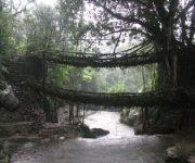
Sohra is not an empty laboratory at the end of a scenic road. The name is often translated as “abode of clouds”, while Cherrapunji reflects its Bengali and colonial-era naming history. Khasi settlements, sacred groves and paths between villages occupy the same plateau that impressed early visitors. Weather knowledge is embedded in oral traditions and practical life, from selecting travel days and reading cloud formations to maintaining community-managed root bridges over seasonal streams.
Formal instrumental records belong to the middle of the nineteenth century, when the British administration in India expanded a network of survey and meteorological observers. Cherrapunji’s station became one of the network’s most consequential sites. Observers measured collected rainwater, recorded times and quantities in station registers, and maintained instruments through exposed conditions. The India Meteorological Department, formally established in 1875, later inherited and standardised much of this work, giving early readings a more durable administrative home.
Those records were initially gathered under colonial rule, so their history deserves a wider lens than simple scientific progress. The network created consistent comparisons across India and connected Sohra to imperial statistics, newspapers and global debates about climate. At the same time, its instruments and terminology reflected the priorities of officials far from the Khasi Hills. Modern historians therefore read the surviving logs for both meteorological value and the power relationships that shaped their collection.
Cherrapunji and Mawsynram’s competing claims
Cherrapunji’s standing and Mawsynram’s modern title can seem contradictory. Cherrapunji retains the historic 24-hour and monthly extremes, while Mawsynram, around 11 kilometres away in the same rain belt, has the higher long-term average used to label the world’s wettest inhabited place. The World Meteorological Organization confirmed Mawsynram’s status in 2015 using its average annual rainfall. “Wettest” therefore has several meanings: a daily peak, a calendar-year total, a monthly peak or an average across many years.
The distinction became clearer when the official meteorological station was shifted from Sohra to Mawsynram in 1938. New measuring arrangements did not create the older records; they changed where the long-running official series was centred. Mawsynram and Cherrapunji also differ in topography, exposure and settlement pattern, so their readings should not be merged into one convenient statistic. The geography is continuous, but the measurement history has separate chapters.
For visitors, the two names often become shorthand for the same experience, yet each offers a different rhythm. Sohra has the stronger association with famous historical readings and established viewpoints, while Mawsynram is central to contemporary rainfall reporting. Exploring Cherrapunji’s best-kept secrets can add context beyond the headline record, showing how waterfalls, caves, forest paths and local traditions are linked rather than isolated as attractions. Wet-weather travel rewards flexibility, local guidance and time to return when a trail reopens.
The extraordinary readings explained
The most frequently quoted figures describe an extraordinary cluster of readings. The historic 24-hour record is generally given as 9,300 millimetres from 1–2 June 1861. A monthly total of 9,461 millimetres was recorded in July 1860, and an annual total of 11,872 millimetres was recorded in 1861. These are not normal totals multiplied by an average rainy day. They represent water accumulated through an unusually persistent monsoon, with repeated pulses of saturated air forced upwards across the ridge line.
Precision deserves care in a record built from manual instruments. Damaged gauges, overflow, missed observation times and the way a reading was assigned to a calendar day can alter historical comparisons. Different later summaries have described the duration of the famous June downpour differently. Modern specialists rely on archived logs, metadata and quality-control methods rather than repeating every number without context. The famous totals remain central to Cherrapunji’s identity, yet their uncertainty is part of the gauge’s contested legacy rather than a reason to discard it.
The physical explanation is clearer than the archival debates. During the southwest monsoon, moisture transported north from the Bay of Bengal moves through the Brahmaputra valley and is lifted over the southern Khasi escarpment. Funnelling and orographic uplift cool the air rapidly, producing cloud, intense rainfall and rapid runoff. Climate researchers now examine whether a warming atmosphere changes the intensity and likelihood of such events. A single nineteenth-century gauge cannot answer that modern question, but it provides a valuable benchmark for contemporary analysis and risk planning.
An Australian lens on rain and travel
Australian weather comparisons make the scale easier to grasp. Sydney’s typical annual total is near 1,200 millimetres, whereas Melbourne receives roughly half that amount; Darwin has a sharper summer monsoon, yet its seasonal patterns and landscape differ from Sohra’s. In Australian cities, daily forecasts from the Bureau of Meteorology often shape school runs, sporting fixtures and commuting, so checking a rain radar before leaving home is a familiar habit. In Meghalaya, the same forecast habit becomes essential because saturated slopes can affect roads and trails.
The Australian travel market is also accustomed to comparing flights, hotels and tour packages online. Travellers can compare published inclusions and operator reviews, but should verify whether a quoted rate covers transport, guide services, meals, entry permissions and weather-related cancellations. Whether a couple, family group or small private party is travelling, the luxury honeymoon inquiry guide provides a useful model for requesting precise room categories, transfer arrangements, dietary details and a clear refund policy before money changes hands.
Australian consumer legislation adds another layer of protection. When an Australian business sells the trip, the Australian Consumer Law requires truthful sales information and fair terms; contracts must also be read under the law that actually governs the transaction. Overseas sellers may operate under different rules, so terms, jurisdiction and insurance need explicit attention. Asking for cancellation deadlines in writing can prevent a delay caused by a landslide or cancelled train from becoming a disputed booking.
Entry rules come from India rather than Australia. Australian passport holders need an appropriate Indian visa for tourism, with the permitted stay and application method checked against current government advice. Sohra itself is not generally an Inner Line Permit destination, although specified tribal areas elsewhere in Meghalaya can have different requirements and rules can change. Travellers should consult Smartraveller, carry the required documentation and obtain travel insurance that covers monsoon disruption and medical evacuation.
Planning a rain-ready journey through Sohra
Timing can make or break a Sohra itinerary. The main monsoon generally builds from April and peaks around June and July, when landslides, road closures and flash flooding become more likely. October through March is usually easier for long walks, although mornings can be cold and rain may arrive unexpectedly. March and April often bring a strong pre-monsoon wet spell. Flexibility is more valuable than a tightly packed checklist, especially when travelling between Sohra, Mawsynram, Nohkalikai and other valleys.
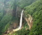
Waterfalls and caves need fresh instructions on every visit. Streams that look manageable can rise quickly, and some cave paths close after heavy rain, even when viewpoints in town remain open. A Wahlkaba Falls guide can help identify the surrounding terrain, but official local notices and guide advice take priority. Allow a dry alternative, keep footwear grippy, carry a small waterproof layer and respect barriers around unstable edges.
Practical choices protect both the journey and the places it visits:
- Travel from October to March for more reliable walking conditions, while treating April to September as a monsoon-focused period.
- Check weather warnings, local administration notices and guide advice before visiting caves, waterfalls or remote paths.
- Carry a waterproof outer layer, pack cover or dry bag, quick-dry clothing and footwear with strong grip.
- Keep a spare travel day and avoid tight onward flight or train bookings immediately after remote excursions.
- Hire local guides, follow community rules at root bridges and ask before photographing ceremonies or sacred places.
- Never cross swollen streams or enter flooded caves, even when the main viewpoint remains open.
Cherrapunjee.net’s two- to seven-night packages can combine resorts and hotels with waterfalls, caves, parks, viewpoints and living root bridges. The strongest itineraries leave room for local weather, include suitable guides and explain which attractions may close after heavy rain. They also connect visitors with Khasi culture rather than presenting Sohra solely as a backdrop for extraordinary statistics.
Book through the contact and booking information published by India Beacons Sojourn on the Cherrapunjee website, specifying travel dates, party size, accommodation preferences and interests in nature, caves or local culture. A flexible package and clear monsoon alternatives will make Cherrapunji’s remarkable rainfall history a safer, more meaningful part of the journey.