





The history of the Sohra rain record
Sohra, widely known as Cherrapunji or Cherrapunjee, occupies a remarkable place in the history of weather observation. Set on the southern edge of Meghalaya’s Khasi Hills, the town faces the moisture-filled monsoon winds rising from the plains of Bangladesh. When that air reaches the escarpment, it is forced upward, cools rapidly, and releases extraordinary quantities of rain.
The numbers associated with Sohra are often presented as simple records, yet they represent much more than a dramatic statistic. They reflect the development of colonial-era meteorology, the practical difficulties of measuring intense rainfall, and the distinctive geography of one of India’s most celebrated high-rainfall regions.
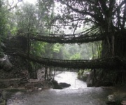
The story also explains why the town remains an important destination for travellers. Waterfalls, caves, forest trails and living root bridges are all shaped by the same wet climate that made Sohra famous. Understanding the rainfall record adds historical depth to a visit, especially during the monsoon season when the landscape becomes most expressive.
How Sohra entered the weather record
Systematic rainfall observation in the Khasi Hills grew during the nineteenth century, when British administrators and surveyors established stations across the region. Reliable weather information was valuable for public administration, road construction, agriculture and understanding the climate of the northeastern frontier. Sohra’s exposed position quickly attracted attention because the settlement received far more rain than nearby upland locations.
Local people had long understood the force and regularity of the seasonal downpours. Khasi communities developed homes, paths and farming practices suited to a wet environment, while traditional knowledge helped people move through steep valleys and forested terrain. The arrival of formal instruments did not create Sohra’s rainy climate; it created a written record of a phenomenon residents already knew intimately.
Early observations must be read with care. Instruments, observing routines and reporting standards changed over time, and older records were not always collected under the same conditions as modern measurements. Even so, the broad pattern is unmistakable: Sohra experienced exceptional monsoon rainfall, with occasional totals far exceeding those recorded in most inhabited places.
The figures behind the famous totals
The most frequently cited Sohra rainfall record concerns the twelve-month period from August 1860 to July 1861. During that period, the station recorded approximately 26,461 millimetres of rain, a total of more than 26 metres. This is commonly described as the greatest rainfall measured at a location over a twelve-month period.
The year 1861 was especially extraordinary because the monsoon produced prolonged and intense precipitation. June alone is often reported at around 9,300 millimetres, though exact figures can vary between historical summaries and modern references. Such differences do not erase the importance of the record; they show why the definition of the measuring period matters.
Sohra also recorded a remarkable annual total of about 24,555 millimetres in 1974. This later figure is frequently mentioned alongside the nineteenth-century record because it demonstrates that the exceptional rainfall was not a one-time historical accident. The region can still generate enormous totals when monsoon circulation, moisture supply and local topography align.
Why the Khasi Hills create such heavy rain
Sohra stands near a steep escarpment overlooking the lowlands. During the southwest monsoon, winds carry humid air northward from the Bay of Bengal and the surrounding plains. The Khasi Hills rise abruptly in front of that air mass, forcing it to climb. As the air rises, it cools and condenses, producing thick cloud, persistent showers and intense bursts of rain.
The geography is particularly effective at concentrating moisture. The nearby plains act as a broad approach route for monsoon winds, while the hills provide the lifting mechanism. Valleys, ridges and exposed slopes then influence where rain falls and how water travels. This is why rainfall can differ considerably between places that are relatively close together.
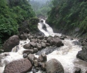
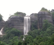
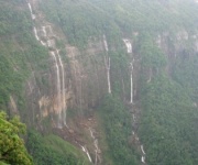
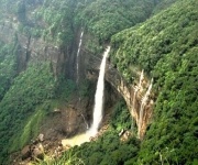
The setting also helps explain the visual character of Sohra. Rainwater cuts through sandstone and limestone, feeds waterfalls such as Nohkalikai and Dainthlen, and supports dense vegetation in sheltered areas. Caves, pools and deeply incised ravines are part of a landscape continuously shaped by runoff. The climate record and the scenery are therefore closely connected rather than separate subjects.
| Period or measurement | Approximate rainfall | Why it matters |
|---|---|---|
| August 1860 to July 1861 | 26,461 mm | Widely cited twelve-month world record associated with Sohra |
| June 1861 | About 9,300 mm | Illustrates the extraordinary concentration of rain during one monsoon month |
| Calendar year 1974 | About 24,555 mm | A later exceptional annual total confirming the area’s extreme rainfall capacity |
| Typical modern monsoon season | Several metres in favourable years | Supports waterfalls, streams and the region’s distinctive ecology |
The record depends on how rain is measured
A rainfall record is meaningful only when the observation period and method are clear. A calendar year runs from January through December, while a hydrological or meteorological year may follow a different cycle. The famous 1860–61 figure covers August to July, capturing a complete seasonal pattern rather than fitting the rain into a calendar year.
Rain gauges also require careful placement and maintenance. The instrument must be positioned at a suitable height, away from obstructions, and checked regularly so that wind, splashing, evaporation or overflow do not distort the result. In a place where rain can arrive in sheets and strong gusts, consistent observation is especially demanding.
Historical comparisons can therefore become misleading when unlike measurements are treated as identical. A station’s location may change, instruments may be replaced, and record-keeping practices may be revised. Modern meteorological services use standardized procedures, while nineteenth-century observations may contain gaps or uncertainties. The Sohra figures remain historically significant, but responsible accounts should preserve that context.
From a global headline to a local identity
For many years, Sohra was described as the wettest place on Earth. That phrase became deeply associated with the town’s name and helped introduce Meghalaya to visitors from across India and abroad. Yet rainfall rankings depend on the period being compared. Mawsynram, located roughly a short distance from Sohra, is often credited with the highest average annual rainfall, while Sohra retains the celebrated twelve-month and single-year extremes.
The distinction between an average and a record is important. A place may have the highest long-term mean, while another holds the greatest rainfall total during a particular year or twelve-month interval. These are different achievements, measured over different spans. The wettest place story offers useful background for understanding why both Sohra and Mawsynram appear in discussions of extreme rainfall.
Rainfall has also influenced the cultural identity of the area. Sohra is not defined solely by statistics. Khasi history, local settlements, sacred groves, traditional pathways and living root bridges all show how people have adapted to a powerful natural environment. The rain record provides a point of entry, but the broader story belongs to the communities and landscapes that have developed around it.
How to experience the record in Sohra
The best way to understand the scale of the rainfall is to observe its effects across the terrain. During the wet season, waterfalls become louder and fuller, mist settles over cliffs, and streams cross roads and footpaths. At other times of year, clearer conditions reveal the escarpment, valleys and rock formations carved by centuries of runoff.
Travellers should remember that dramatic weather can also affect transport and access. Heavy rain may slow roads, make steps slippery and reduce visibility around viewpoints. A flexible itinerary is useful, especially for visits to remote waterfalls, caves and root bridges. Local guides and experienced drivers can help visitors assess conditions and choose safe routes.
A stay of several days gives the region more justice than a rushed stop. One day can be devoted to Sohra’s major waterfalls and viewpoints, another to caves or forest areas, and another to villages and living root bridges. Resorts and hotels in and around Cherrapunjee provide different levels of comfort, while a local tour package can simplify transport between scattered attractions.
Practical choices for a rain-focused journey
The rainfall record is most rewarding when paired with sensible preparation. The heaviest showers do not occur every day or in the same way, and conditions can change quickly. A clear morning may become misty and wet by afternoon, while a short break in the rain can reveal views that were hidden moments earlier.
Visitors should also treat the landscape with care. Wet rocks, steep paths and fast-flowing streams can be hazardous, particularly near waterfall edges and cave entrances. Respecting local guidance protects both travellers and the fragile surroundings that make Sohra special.
- Carry a waterproof outer layer, quick-drying clothing and sturdy footwear with good grip.
- Keep phones, cameras, documents and medicines in sealed waterproof bags.
- Allow extra travel time for slippery roads, traffic and sudden weather changes.
- Use local guides for caves, root bridges, forest routes and less familiar trails.
- Check seasonal conditions before setting out for waterfalls or remote viewpoints.
A visit arranged around the rain record can combine historical curiosity with direct experience. Travellers can learn how nineteenth-century observers documented the monsoon, then see the streams, cliffs and forests that give those measurements physical meaning. This approach turns a weather statistic into a fuller understanding of Sohra’s environment and heritage.
Plan your Cherrapunjee journey with time for both the famous sights and the quieter details of the Khasi Hills. Explore the waterfalls, caves, villages and living root bridges, and choose a multi-day itinerary that leaves room for changing weather. Contact the Cherrapunjee travel team to arrange a suitable Sohra holiday package and experience the landscape shaped by one of the world’s great rain records.