





Scenic Drives Around The Cherrapunjee Plateau
The road from Shillong to Cherrapunjee, also known as Sohra, is one of Meghalaya’s most memorable journeys. It climbs and descends through misty hills, open grasslands, dense forest and steep valleys, with viewpoints appearing around bends rather than at carefully marked tourist stops. For Australian travellers, the route offers a striking change from the broad highways and dry inland landscapes familiar around Brisbane, Melbourne or Perth.
Sohra sits on a high limestone plateau in the Khasi Hills, an area famous for intense monsoon rainfall. Water has shaped the landscape into cliffs, gorges, caves and waterfalls, while Khasi villages and forest tracks add a human dimension to the scenery. A scenic drive here is rarely just a transfer between attractions; the changing light, cloud and vegetation are part of the experience.
Most visitors base themselves in or around Cherrapunjee for several nights and explore by car with a local driver. This is usually more comfortable than hiring a vehicle for self-drive, particularly on narrow roads, in heavy rain or after dark. Driving is on the left, which may feel familiar to Australians, but road conditions, overtaking habits, livestock and sudden pedestrians require much greater concentration.
The best journeys combine a main road with short walks and time to stop. Pack waterproof layers, sturdy shoes and a day bag for changing conditions. An Australian passport holder should also arrange the appropriate Indian visa before departure, check travel insurance for activities such as hiking, and allow extra time when rain, roadworks or local traffic slow the route.
The Shillong To Sohra Mountain Road
The classic approach begins in Shillong, Meghalaya’s hill capital, and follows the route south towards Sohra. The road leaves the city’s busier streets and gradually opens into rolling uplands, pine stands and broad viewpoints. Early in the day, the air can be cool and clear; later, cloud may settle across the plateau and give the landscape a soft, silver appearance.
Mawkdok Dympep Valley is a natural pause on the journey. From the viewpoint, the land falls away into a deep, forested valley, with ridges layered towards the horizon. It is worth stopping before the main sightseeing areas, as the viewpoint shows how dramatically the plateau breaks towards the plains of Bangladesh.
The drive is approximately 50 to 55 kilometres, but the time required depends on traffic and stops rather than distance. A private car can make the journey in a few hours, while a sightseeing day takes longer. Leave Shillong after breakfast, carry drinking water, and avoid planning a tightly timed connection from this route.
Waterfalls And Limestone Country
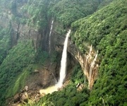
Near Sohra, the road branches towards some of Meghalaya’s best-known natural landmarks. Nohkalikai Falls is the essential stop when weather conditions provide visibility. The waterfall drops from the plateau into a vivid blue-green pool, and the surrounding cliffs become especially dramatic when thin cloud drifts through the gorge.
Dainthlen Falls offers a different setting, with a broad rocky landscape and a waterfall associated with Khasi folklore. In the wet months, the water can be powerful and the paths slippery. Mawsmai Cave is another convenient addition to a driving circuit, though visitors should expect low ceilings, uneven rock and narrow passages rather than a polished show-cave experience.
These stops work well together because they are relatively close to Sohra. A driver can create a loop that includes Nohkalikai, Mawsmai, Dainthlen and nearby viewpoints without repeatedly covering the same road. Keep an eye on footwear: lightweight runners may be fine in dry weather, but sandals are poor protection on wet stone.
Forest Roads To Living Root Bridges
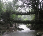
The journey to the living root bridges begins with a drive towards Tyrna, followed by a demanding descent on foot. The most famous bridge at Nongriat cannot be reached by car, and the final approach involves many steps through humid forest. The drive is therefore best treated as the first part of a full-day walking excursion rather than a quick attraction stop.
Local communities have trained the aerial roots of rubber fig trees over streams for generations, creating living crossings that strengthen as they grow. The route reveals a quieter side of the plateau, with small settlements, jungle shade and rushing water replacing the open viewpoints around the main road. A guide is strongly advisable, especially after rain.
The return climb can be strenuous in tropical heat. Travellers from Australia who are accustomed to weekend bushwalks should still take the gradient seriously, as humidity and stone steps add difficulty. Begin early, carry water and snacks, and confirm the condition of the trail with your driver or accommodation before leaving.
| Drive Or Excursion | Landscape And Highlights | Time To Allow | Best For |
|---|---|---|---|
| Shillong to Sohra | Pine hills, valley viewpoints and Mawkdok Dympep | Half a day with stops | First-time visitors |
| Sohra waterfall circuit | Nohkalikai, Dainthlen, viewpoints and cave country | Full day | Scenic variety |
| Tyrna and Nongriat | Village road, forest trail and living root bridge | Full day or overnight | Active travellers |
| Sohra to Laitkynsew | Plateau edges, forest and quieter rural scenery | Half to full day | Slower exploration |
| Sohra to Dawki | Hills, river landscapes and border-region scenery | Long day or overnight | Extended road trips |
| Shillong to Sohra in wet weather | Cloud, rain-fed streams and powerful falls | Flexible full day | Monsoon atmosphere |
Quieter Drives Beyond The Main Circuit
Travellers with extra time can explore the roads towards Laitkynsew and nearby plateau villages. These routes generally feel less concentrated than the Nohkalikai and Mawsmai circuit, with more space for rural views, cultivated slopes and forest edges. The appeal is the journey itself: there may be no major landmark at every stop, but there is a greater sense of everyday life in the Khasi Hills.
The road towards Dawki makes a much longer excursion and is best planned as an overnight journey or as part of a wider Meghalaya itinerary. The landscape changes as the route descends towards the Umngot River, known for clear water in favourable conditions. Shnongpdeng is associated with river activities, while Dawki is close to the India–Bangladesh border, making the area subject to official boundaries and local regulations.
Do not assume that a famous photograph represents conditions throughout the year. River clarity varies with rainfall, and monsoon water can turn a transparent channel into a fast-moving, sediment-filled river. A local operator can advise whether boating or riverside activities are running safely on the day.
Choosing The Right Season For A Drive
The Cherrapunjee plateau has a reputation for rain, but conditions vary across the year. The monsoon, broadly from June into September, brings the fullest waterfalls and intense green foliage. Roads can be slick, visibility can fall quickly and outdoor plans may need to change. Travellers who enjoy dramatic weather may find this the most atmospheric period, provided they build flexibility into the itinerary.
The cooler and generally drier months from October to April are often easier for viewpoints, caves and walking routes. Waterfalls may be less forceful, yet clearer skies can reveal deeper valley views. December and January mornings can feel surprisingly chilly, particularly in open areas, so a light fleece or jacket is useful even for visitors arriving from warm Australian cities.
Rain should influence departure times. Leave early for longer drives, keep a waterproof cover over phones and cameras, and allow time for traffic near Shillong. Unlike a road trip between Sydney and Canberra, where distances and travel times are usually predictable, Meghalaya routes can take much longer than the map suggests.
Practical Details For Australian Travellers
A local car and driver is the most reliable arrangement for touring the plateau. Self-drive hire may be possible through selected providers, but it is not the easiest choice for a first visit. Roads can be narrow, lane discipline varies, and navigation may be complicated by limited signage. Australians are used to left-side driving, yet Indian mountain roads demand different expectations about horns, overtaking and roadside activity.
Carry Indian rupees for small cafés, parking areas, village contributions and local guides. Card payments and mobile wallets are more common in towns, but connectivity and acceptance can be inconsistent in rural areas. Australian dollars cannot be used directly, and exchanging some money before heading into the countryside is sensible. An eSIM or local SIM can help with navigation, although coverage may disappear in valleys.
Respect local instructions near caves, waterfalls and border areas. India’s national and state regulations govern protected spaces, photography, transport and entry, while local community arrangements may apply at walking trails. Keep identification, visa details and travel insurance information accessible, and check current entry requirements through official Indian government sources before departure.
For families travelling across generations, the route needs careful pacing. Short viewpoint stops and waterfall walks suit mixed abilities better than combining them with the Nongriat trek on the same day. This family travel guide can help with balancing activity, rest and transport when several age groups are travelling together.
Building A Scenic Driving Itinerary
A two-night stay allows a straightforward Shillong-to-Sohra journey, one waterfall circuit and a little time for local markets or relaxed viewpoints. Three or four nights create room for the living root bridge trek, quieter roads towards Laitkynsew and a weather buffer. Longer Meghalaya packages can add Mawlynnong, Dawki, Jowai or other destinations without forcing every day into a long transfer.
Arrange accommodation in advance during holiday periods and peak travel months. Resorts around Sohra range from practical guesthouses to more comfortable properties with valley views. Ask about hot water, generator backup, mobile coverage, meal times and the condition of the access road, as these details can matter more than a glossy room photograph.
A scenic route is most rewarding when it leaves space for unplanned pauses. Stop at viewpoints only where parking is safe, avoid standing close to cliff edges, and keep valuables out of sight in the vehicle. The plateau’s weather can turn a familiar road into a completely different landscape within minutes.
Smart Ways To Prepare For The Road
- Book a local driver familiar with Shillong, Sohra, Tyrna and the seasonal road conditions.
- Carry waterproof footwear, a rain shell, quick-drying clothes and a small towel.
- Keep cash in Indian rupees for rural stops, guides, parking and refreshments.
- Plan waterfall and cave visits early, leaving room for rain-related delays.
- Bring prescription medicines, sun protection, insect repellent and reusable water bottles.
- Check visa, insurance, weather and local access information before leaving Australia.
- Choose an itinerary that matches the group’s walking ability and fitness.
A well-planned drive around the plateau combines famous viewpoints with quieter village roads, forest paths and changing weather. Whether the priority is waterfalls, caves, living root bridges or wide valley scenery, the route becomes richer when each stop is given enough time.
Explore the available Cherrapunjee tours and accommodation options, then contact India Beacons Sojourn to shape a Meghalaya journey around your dates, interests and preferred pace.