





The most scenic drives around Cherrapunjee
Cherrapunjee, also known as Sohra or Cherrapunji, is best experienced from the road. The journey through Meghalaya’s East Khasi Hills moves between misty ridges, deep gorges, forested slopes, limestone formations, and waterfalls that appear beside the route after rain. Short distances can take time because the landscape invites frequent stops. Learn more about Visiting The Mawlynnong Village Asia S Cleanest Village.
A drive around Sohra is rarely just a transfer between attractions. Viewpoints open suddenly beside winding roads, village lanes lead toward living root bridges, and clouds can transform a familiar valley within minutes. The most rewarding itineraries leave room for photographs, tea breaks, and changes in weather.
The routes below combine famous roads with quieter scenic stretches. Some are suitable for a relaxed half-day outing, while others work better as full-day excursions from a resort or hotel in Cherrapunjee. A local driver is especially useful for narrow roads, monsoon conditions, and visits that require walking beyond the vehicle.
The Shillong to Sohra road
The classic approach to Cherrapunjee begins in Shillong and follows the plateau toward Sohra. This drive is one of Meghalaya’s most memorable road journeys because the scenery gradually changes from the busy state capital to open highland countryside. Pine trees, rolling grasslands, village settlements, and distant cloud-covered hills appear along the way.
Mawkdok Dympep Valley is a major highlight on this route. From the roadside viewpoint, the land falls away into a dramatic green gorge, often veiled by drifting mist. The sight is particularly atmospheric during the monsoon, although rain can reduce visibility and make the viewing area slippery. Early morning departures from Shillong can provide softer light and fewer vehicles.
The route also passes through local communities where small stalls sell tea, snacks, seasonal fruit, and handmade products. Rather than treating the drive as a quick ride to the destination, allow extra time for viewpoints and roadside stops. The road distance is modest, but the combination of traffic, curves, and photo breaks can extend the journey.
Waterfalls and viewpoints near Sohra
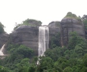
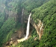
Once you reach the Cherrapunjee plateau, several scenic drives can be combined into a waterfall circuit. Nohkalikai Falls is usually the first major stop for visitors. Its long white ribbon drops into a deep blue-green pool surrounded by forested cliffs, creating one of the most recognizable landscapes in Meghalaya. The viewpoint is close to the main road, making it easy to include in a half-day excursion.
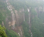
Seven Sisters Falls, also called Nohsngithiang Falls, is another essential stop during the rainy season. Multiple streams descend over a broad cliff face, although the flow may be much lighter outside the monsoon months. The outlook is especially beautiful when the clouds lift enough to reveal the plains stretching toward Bangladesh.
The road between these attractions includes smaller viewpoints and access points to caves, forest paths, and village areas. Mawsmai Cave is convenient for travelers who want to see Meghalaya’s limestone landscape without committing to a long trek. The cave path can be narrow and uneven, so footwear with a firm grip is more practical than open sandals.
The living root bridge route
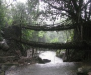
A drive toward Tyrna and the Nongriat trailhead offers a different kind of scenery. The road leaves the more concentrated tourist zone and moves through quiet Khasi villages, cultivated slopes, and forested hills. Tyrna is the usual starting point for the walk to the famous Double Decker Living Root Bridge, but the final attraction is reached on foot rather than by car.
The drive is scenic because it approaches the hills from a quieter side, with occasional views across deep valleys. However, the walk from Tyrna involves many steps and can take several hours each way depending on pace, weather, and stops. Travelers should begin early, carry water, and consider their fitness before adding this excursion to a tightly timed itinerary.
Living root bridges are formed by guiding the roots of rubber fig trees across streams over many years. They are a remarkable example of local ecological knowledge and patient community stewardship. Travelers interested in seeing a different side of Meghalaya’s village life can also read about Mawlynnong village, which is often paired with scenic drives in the region.
| Drive | Approximate time from Sohra | Main scenery | Best suited to |
|---|---|---|---|
| Nohkalikai and Mawsmai circuit | Half day | Waterfalls, caves, forested cliffs | First-time visitors |
| Tyrna and Nongriat approach | Full day | Villages, valleys, living root bridge trail | Active travelers |
| Mawlynnong and Riwai | Full day | Rural roads, forests, root bridge | Scenic day trips |
| Dawki and Shnongpdeng | Full day or overnight | River gorge, hills, border landscapes | Road-trip travelers |
| Mawsynram direction | Full day | Open plateau, wetland scenery, quiet villages | Repeat visitors |
| Shillong to Sohra | One-way journey | Pine hills, gorges, viewpoints | Arrival or departure day |
The road to Mawlynnong and Riwai
The drive from Cherrapunjee toward Mawlynnong leads through a quieter part of the East Khasi Hills. The route includes forested sections, cultivated land, and villages spread across ridgelines. The road itself is a major part of the experience, particularly when low clouds move across the hills and sunlight breaks through in patches.
Mawlynnong is known for its carefully maintained village environment and community-led cleanliness initiatives. Nearby Riwai is home to a single-decker living root bridge, reached by a relatively short walk through greenery. The setting is peaceful, and the route allows visitors to appreciate how bridges, forests, paths, and settlements form part of the same living landscape.
This is a long outing from Sohra, so it is better planned as a full-day drive rather than combined with too many attractions. A driver familiar with the area can help coordinate village visits and road conditions. Leave early, especially during weekends and the wet season, when narrow stretches may become slow.
The Dawki and Shnongpdeng journey
For a longer road adventure, travel from Cherrapunjee toward Dawki and Shnongpdeng. The landscape changes as the route descends from the plateau toward the Umngot River. Hills become more pronounced, roads wind through forest and farmland, and the air often feels warmer at lower elevations.
Dawki is known for its river, border location, and seasonal views of exceptionally clear water. Shnongpdeng, farther along the river, is associated with boating, kayaking, and riverside stays. Water clarity varies with weather, river conditions, and season, so visitors should treat photographs of glass-like water as a best-case possibility rather than a daily guarantee.
This drive deserves a full day at minimum, and an overnight stay can make the journey more comfortable. Returning to Sohra after river activities may involve several hours on winding roads. The route is particularly attractive to travelers who want to combine waterfalls and caves with a broader Meghalaya road trip.
A quieter drive toward Mawsynram
The road toward Mawsynram offers an alternative to the better-known waterfall circuit. This highland area is associated with intense rainfall, open landscapes, rocky outcrops, village roads, and broad views across the Khasi hills. It can feel less crowded than the main Sohra attractions, making it appealing for travelers who prefer slower travel and fewer organized stops.
The scenery is subtle rather than concentrated in one landmark. Instead of moving from one famous viewpoint to another, the pleasure comes from changing cloud formations, isolated homes, grazing animals, patches of forest, and ridges disappearing into the distance. A local guide or driver can identify suitable stops and avoid private land or difficult side roads.
Weather is a major factor on this route. Mist may create a dramatic atmosphere, while heavy rain can obscure the views and slow progress. On a clear morning, the open plateau provides some of the best opportunities for landscape photography around Cherrapunjee.
Planning a comfortable road day
Scenic driving in Meghalaya requires a flexible schedule. A route that appears short on a map may take much longer because of curves, road repairs, traffic near villages, or time spent walking to viewpoints. It is wiser to choose two or three principal stops than to rush through a long list of attractions.
Carry a light rain jacket, water-resistant footwear, sun protection, drinking water, and a small daypack. Temperatures can shift quickly between exposed viewpoints and shaded valleys. In the rainy months, protect cameras and phones in waterproof covers, and keep spare clothing in the vehicle.
The following choices make a road-based Cherrapunjee itinerary easier to manage:
- Choose a local driver who knows viewpoint entrances, village roads, and seasonal conditions.
- Start early for Nongriat, Mawlynnong, Dawki, and other full-day excursions.
- Keep cash available for entry fees, parking, local guides, and small village purchases.
- Wear shoes with reliable grip for caves, wet paths, steps, and waterfall viewpoints.
- Check the forecast, but expect conditions to change quickly on the plateau.
A two-night stay can cover the main waterfall and cave circuit, while longer packages allow time for Nongriat, Mawlynnong, Dawki, or Mawsynram without making every day a race. Travelers who want a compact itinerary can review the 2-night Sohra package as a starting point and adjust the sightseeing plan around weather and walking ability.
Choosing the right season
The monsoon, generally from June through September, produces the strongest waterfall displays and the lushest scenery. Roads may be wet, visibility can change within minutes, and some trails become slippery. The reward is a landscape at its most dramatic, with streams flowing over cliffs and hills covered in intense green.
October through April often brings clearer skies and more dependable road conditions. Waterfalls may be less powerful, but distant views, caves, village walks, and photography can be more comfortable. Winter mornings can be cool and misty, while sunny afternoons are usually pleasant for driving.
For a balanced trip, many visitors combine one waterfall-focused day with one village or root-bridge excursion and one longer drive toward Dawki or Mawsynram. This creates variety without repeating the same type of scenery. It also leaves room to move activities if rain affects visibility.
A road journey through Cherrapunjee is best measured by the quality of the stops rather than the number of places checked off. Follow the curves beyond Sohra, pause where the hills open, and allow the weather to shape the day. For reservations, route planning, and multi-day Meghalaya stays, contact India Beacons Sojourn through Cherrapunjee.net and arrange a scenic drive that fits your schedule.