




The Story of the Khasi Hills and Their Ancient Forests
In the eastern hills of Meghalaya, cloud, rain, rock, and forest have shaped one another for thousands of years. The Khasi Hills rise as a green plateau above the plains of Bangladesh, with deep valleys, limestone outcrops, rushing streams, and waterfalls that appear wherever the monsoon finds a path through the land. Cherrapunjee, also known as Sohra or Cherrapunji, stands within this remarkable landscape.
The region is widely known for extraordinary rainfall, yet water is only part of its story. The Khasi Hills are also a cultural landscape, shaped by village traditions, sacred forests, living root bridges, shifting cultivation, and a long relationship between people and native trees. Their forests are habitats, archives, and places of spiritual importance.
A journey through Sohra is therefore more than a scenic holiday. It is an opportunity to understand how geography influenced Khasi life, how forest communities protected rare ecosystems, and why ancient environmental customs remain relevant today.
A Plateau Sculpted By Rain
The Khasi Hills form part of the Meghalaya Plateau, a highland region separated from the Brahmaputra Valley to the north and the broad lowlands of Bangladesh to the south. Moisture rises from the Bay of Bengal and encounters the steep southern escarpment. As the air climbs, it cools and releases intense rain over the hills.
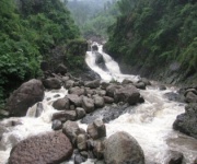
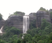
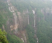
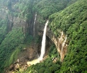
This natural process created the dramatic scenery associated with Cherrapunjee. Seasonal streams cut through sandstone and limestone, producing gorges, pools, and cascades. Waterfalls such as Nohkalikai, Dainthlen, and Wei Sawdong are expressions of the same geological forces that carved the valleys. During the wet season, the landscape becomes saturated with sound: rain on leaves, water over stone, and streams swelling below forested slopes.
The climate also encouraged a dense range of plant life. Ferns, mosses, orchids, bamboo, wild herbs, and broad-leaved trees thrive in shaded and humid conditions. In some areas, the forest canopy is broken by grassland or exposed rock, creating a varied mosaic rather than a single uniform woodland.
Visitors who want to experience the connection between weather and terrain can follow a rain lover’s guide before planning walks, waterfall visits, and village excursions. Rain changes the appearance and accessibility of many sites, so timing and suitable clothing matter.
Forests That Hold Living Memory
The ancient forests of the Khasi Hills are often described through their biodiversity, but their value extends beyond lists of species. A mature forest stores layers of memory in its trees, springs, animal paths, and customary boundaries. It can reveal how a community has used land, protected water, and passed knowledge between generations.
Khasi forests include evergreen and semi-evergreen habitats, subtropical woodland, pine areas, bamboo stands, and pockets of dense native vegetation. The composition changes with elevation, soil, exposure, and human use. In shaded ravines, tree trunks may be covered with moss and climbing plants. On drier ridges, sunlight reaches the forest floor and different grasses and shrubs appear.
These habitats support birds, butterflies, amphibians, reptiles, and small mammals. The clouded leopard is among the region’s best-known wildlife species, although sightings are rare and visitors should never expect to encounter one. More commonly observed are birds moving through the canopy, insects around wet foliage, and frogs calling from streams after rain.
The forest also provides practical benefits. Trees stabilize slopes, roots hold soil during heavy rainfall, and leaf litter helps retain moisture. Springs and underground water systems depend on vegetation cover. When woodland disappears, runoff becomes faster, erosion increases, and the delicate balance between hilltop and valley is disturbed.
Khasi Custom And Sacred Groves
Some of the most important forest remnants in Meghalaya are sacred groves, known locally by names such as law kyntang and law shnong. These protected patches are connected with local religious traditions and community identity. Many have been preserved through customary rules that restrict tree felling, hunting, grazing, and the removal of plants or stones.
The grove is not treated as an ordinary resource. It may be associated with a guardian spirit, a clan tradition, or a village’s collective history. Elders and community institutions have traditionally helped maintain the rules governing entry and use. This system allowed forest fragments to survive even as surrounding land was cleared for settlement, agriculture, roads, or fuel.
Sacred groves can appear quiet and compact, yet their ecological importance is considerable. Old trees create shade and shelter, while undisturbed soil supports fungi, insects, seedlings, and other organisms that may be missing from managed landscapes. Springs within or near these forests can feed streams used by nearby communities.
Visitors should enter such places respectfully. The absence of fences does not mean unrestricted access. Local instructions, photography customs, footwear expectations, and restrictions on collecting natural objects should be followed. The best experience comes from observing the grove as a living cultural institution rather than treating it as a conventional sightseeing stop.
Living Root Bridges And Forest Knowledge
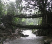
The living root bridges of the Khasi and Jaintia Hills show how closely local engineering developed alongside the forest. Communities trained the aerial roots of rubber fig trees, guiding them across streams with the help of bamboo, wood, or other temporary supports. Over many years, the roots thickened, intertwined, and formed a durable crossing.
Unlike a bridge built from fixed materials, a living root bridge continues to grow. It may become stronger with age, although heavy use and changing weather can still cause damage. The structure reflects patience: a useful crossing could take years or even decades to mature. Its creation required detailed knowledge of tree behavior, water flow, slope, and seasonal conditions.
The famous double-decker root bridge near Nongriat is one of the region’s best-known attractions, reached by a demanding descent and ascent through forested terrain. Other root bridges are found in villages around Sohra, sometimes along trails leading to waterfalls and natural pools. Each crossing belongs to a particular landscape and community, with its own history of care.
These bridges also demonstrate a broader Khasi understanding of nature. The forest is not merely a barrier to be cleared or a backdrop for travel. It can be a partner in building, transport, water management, and everyday life. The technique turns a living organism into infrastructure without removing it from the ecosystem.
| Feature | What It Reveals | What Visitors Should Know |
|---|---|---|
| Sacred groves | Customary conservation and spiritual values | Follow local rules and avoid removing anything |
| Living root bridges | Long-term ecological engineering | Trails can be steep, wet, and physically demanding |
| Limestone caves | Water erosion and underground geology | Carry reliable lighting and use care on slippery ground |
| Waterfalls and streams | The force of monsoon runoff | Conditions can change quickly after heavy rain |
| Forest villages | Continuing relationships with land | Travel respectfully and support local guides |
Caves, Waterfalls, And Forest Trails
The natural history of the Khasi Hills is visible above ground and below it. Limestone formations contain caves shaped by water passing through cracks and bedding planes. Some caves are short passages suitable for cautious exploration, while others extend into complex underground systems with narrow sections, dark chambers, and seasonal streams.
Mawsmai Cave near Sohra is a popular introduction to the area’s limestone landscape. Its chambers and low passages reveal how rock, rain, and time interact. Deeper cave systems in Meghalaya attract experienced explorers and researchers, but visitors should distinguish between an accessible tourist cave and a technical expedition. Proper guides, footwear, lighting, and knowledge of local conditions are essential.
Waterfalls provide another way to read the terrain. Nohkalikai drops from the plateau toward a striking blue-green pool, while Dainthlen is associated with Khasi legend and a long cascade over rock. In monsoon months, familiar viewpoints may be surrounded by mist and spray; in drier periods, trails and rock formations are easier to distinguish.
Walking through these areas rewards slow observation. Look for tree roots gripping exposed soil, orchids attached to branches, tiny plants growing in rock crevices, and changes in vegetation between ridge and ravine. Staying on established paths helps protect fragile ground, particularly near caves, cliff edges, and shallow-rooted plants.
A Journey Through Landscape And Legend
Khasi history is preserved in oral traditions, place names, clan relationships, and stories connected with rocks, rivers, forests, and animals. Legends surrounding waterfalls and caves are not separate from the physical landscape; they give meaning to features that might otherwise be viewed only as geological attractions.
Sohra was historically an important Khasi settlement and later became known internationally through colonial-era accounts of rainfall. The older name, Cherrapunjee, remains widely used in travel writing, while Sohra is common in local and official usage. Understanding both names makes it easier to follow maps, signs, and conversations during a visit.
A thoughtful itinerary can combine viewpoints and major attractions with less hurried experiences. A multi-day stay allows time for forest walks, village visits, caves, waterfalls, and root bridges without reducing the hills to a series of quick photographs. Local guides can explain trail conditions, customs, plant uses, and the stories associated with particular places.
Travel also creates a responsibility to protect the setting that makes the journey meaningful. Waste, loud behavior, damage to vegetation, and careless movement around water can quickly affect narrow trails and small communities. Choosing locally operated accommodation, guides, drivers, and food providers helps keep more of the visitor economy within the region.
Practical Ways To Travel Responsibly
The weather should shape preparation. A waterproof outer layer, quick-drying clothing, sturdy shoes with good grip, a small first-aid kit, and protection for phones or cameras are useful throughout the year. Even during a bright morning, clouds can build rapidly over the plateau.
Long walks to root bridges, caves, and waterfalls may involve hundreds of steps, uneven stones, mud, and slippery slopes. Visitors should allow extra time, carry drinking water, and avoid rushing on descents. A guide is particularly valuable on less familiar forest routes or after heavy rain, when streams and trail surfaces can change.
Responsible travel also means treating Khasi communities as hosts and partners rather than as part of the scenery. Ask before photographing people, homes, ceremonies, or private land. Avoid picking flowers, carving trees, feeding wildlife, or taking stones from caves and groves. Pack out every item brought onto a trail.
Helpful Habits For Exploring The Hills
- Choose a licensed or locally recommended guide for remote trails and cave visits.
- Carry reusable water bottles, rain protection, and a small bag for personal waste.
- Wear shoes designed for wet, uneven ground rather than smooth-soled casual footwear.
- Respect sacred-grove rules, village customs, and signs that restrict access.
- Keep waterfalls, root bridges, and forest paths quiet, clean, and free from damage.
The story of the Khasi Hills continues through every stream, root bridge, village path, and protected grove. Plan a stay in Sohra that leaves room for rain, conversation, and unhurried walking, then explore the forests and living landscapes with care through a Cherrapunjee.net tour or vacation package. Your journey can become part of the region’s continuing story while helping preserve its ancient forests for those who follow.